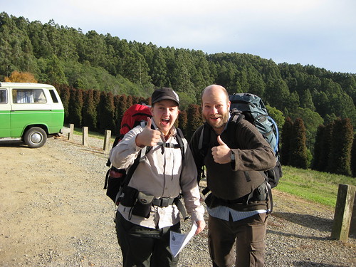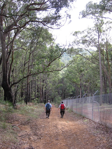
View from the start of the walk, 9:30am.

Me and DB give this the thumbs up already! (Photo by SJ)
The route follows unsealed tracks and unsealed footpaths, it includes some steep ascents and descents. Although it is only 14km long, I would rate it as one of the more difficult walks we’ve done. This is mainly due to the constant climbing/descending: there is very little distance covered over flat ground. It is also to do with walking on bush tracks and footpaths, which are often uneven, slippery with wet leaves, or obstructed by fallen branches and overhanging foliage – it takes a lot of mental energy to continuously pay attention to where you’re walking. I slipped over at the start of the walk, landing on my bum and pack (good reason to have a nice big pack, to buffer the landing) jarring my shoulder and bruising my hand. Going down steep hills is hard!

I think this was just before I fell over! (Photo by SJ)

Board track, beside the grounds of Silvan Reservoir
The other reason I’d rate this harder than average is that the Melways maps, the maps from Parks Victoria and Google Maps often don’t match up, or show conflicting information, thus some small amount of navigational skill is needed to route find. For what it’s worth, if you are going with one map only, I’d use the Parks Victoria one because although it doesn’t show all the tracks, the ones it does show are in the right places. I love maps.

Yes, I do like maps! (Photo by SJ)
We crossed paths with two or three small groups of bushwalkers, and amused ourselves by talking about feral park rangers turned cannibal jumping out and attacking bushwalkers with chainsaws. THAT WAS FUN. We also talked about how if you were going to eat a member of your party, you would totally start with their arms, so they could still walk. Ummm . . . *shifty eyes* WE'RE NOT REALLY THAT CREEPY, I SWEAR! OK, maybe a bit. Anyway! We saw a shitload of bikers going down hills at top speed. That way lies broken collarbones, people! DON'T DO IT! We also gave directions to a couple of chaps who were strolling around clutching bottles of beer - we knew we were getting close to the end when we started seeing people in jeans walking around! However, for the most part this was a gloriously quiet walk, with just us, the trees, the ferns, the birds and the water to make noise.

DB with a tall tree
Last time we walked here, we were absolutely knackered at the end, and went to E’s mum’s place and fell asleep on the couch! This time we did a longer route (14km instead of about 11km), and I think we avoided the very steepest section of last time. Mind you, it was still rather steep in parts!

Note the sweat! It was pretty steep!
We definitely noticed an improvement in our endurance and recovery, though, because this time we were not completely wiped out, and in fact still had the energy to sing Beatles songs at the top of our lungs (substituting lyrics to make them even creepier than they are) on the way home. It’s nice to know that we’re getting better, especially as D & I were carrying our big packs this time (full of phone books!)

D & SJ heading uphill after lunch.
In conclusion, this walk is highly recommended, especially in autumn as the leaves from the deciduous trees in the arboretum are changing and falling (I’d suggest April-May as a guide). It is lovely to see the contrasts between the drier bush, the rainforest in the creeks and the European/Asian/American trees on the slopes. This walk has gorgeous views at the start and also climbing out of the valley at the end, and gives a great sense of accomplishment to complete.

View back over walk and valley (Photo by SJ)

View back over the arboretum and national park
I would recommend a shorter walk (down to Valley Picnic Ground and back, or a less steep route involving driving to the bottom of the valley) to people who don’t have a moderate level of fitness. You need to take ample food and drinking water, as none of the water en route is potable. There are BBQ and toilet facilities at the start/end and at Valley Picnic Ground. The walk is not PT accessible, and is not wheelchair, scooter or pram accessible.

SUCCESS! Us at the end of the walk!
More of my photos can be found by clicking here.
SJ’s new camera can be seen in action by clicking here.
Happy birthday, SJ!
No comments:
Post a Comment