26 June 2009

WALK: LAVERTON TO ALTONA: 21 JUNE 2009

This is just going to be a quick post, because I can't really be bothered giving an extensive review! We planned to do this walk, from Laverton Station down Laverton Creek to 100 Steps to Federation, then across the creek and north around the bay to Altona, up past the station, around Cherry Lake and back to the station. But when we reached Cherry Lake, I couldn't be bothered walking any further (I was really tired, the weather didn't look so promising, and both SJ and I had left our raincoats at home). So we ended up walking about 11km in total. Then we went to SJ & E's place, and I had a tiny nap. THEN we went to EJ's birthday drinks at Madam Brussels.

Our camera was not working, so all these photos are by SJ. You can find the whole set by clicking here.

The before picture - note SJ's excellent tweed hat!


We saw lots of birds:


We had tea at the top of the 100 Steps, under the Time Beacon.


We were outraged that the city was the wrong way round from this angle. There were some pretty cool clouds, too.


Some of us weren't creepy:


We walked to the end of Altona Pier and ate chips!


We admired the informative signs:


Then we went home. E picked us up from the station, and then SJ drove us into the city for drinks!


It was a nice day!

25 June 2009

PAINNNNN...

i think i mentioned a little while ago that i was going to the poditrist. i did, she's great. i went because i hadn't had new orthotics since 1997, but the propelling factors were: i was getting shin splints (PAINFUL) and i needed new walking boots (i wanted to get ones that would fit my new orthotics).

anyway, my podiatrist suggested that even if my shin splints had calmed down (they have), i should get some remedial massage in order to help heal the muscle properly and reduce the risk of recurrence/future injury. i noticed that my chiropractor also has a massage therapist and myotherapist working from the same location, so i asked her about which i should see. she recommended the myotherapist.

this afternoon i am heading down to carlton north and offering my legs up for some intense pain! i hope it all goes well. i will report back.

*

the latest walks i've done. hm. on the weekend, sj, d and i walked from laverton station down laverton creek to the bay, and then up to altona, where we had chips on the pier! it was lovely. we also went and looked at cherry lake, but i couldn't be bothered walking all the way around. so it was a short walk (about 11km?) for the shortest day of the year. my camera was not working, so i have no photos. sj took pics, though, so when she uploads them i will make a post!

yesterday was our good friend e's birthday, and i walked 8.5km to her birthday brunch. i noticed that my shins felt a little crampy, almost like shin splints but not as painful. this cleared up after i walked about 4km (and, i noted, this was as i walked a distance over dirt paths and grass rather than concrete). i think this is partially due to the stiff soles of my new hiking boots - they bend fine when i am carrying a heavy pack, but not so much when i just have my daypack on. the toe not flexing enough causes those lower leg muscles to work harder to compensate, and ouchness ensues.

18 June 2009

MORE PHOTOS OF THE CIRCLE RAILWAY WALK

My parents took some photos on the day and emailed them to me. I've just got around to uploading them to flickr, and you can see them by clicking here.

j & g and train-themed play equipment

14 June 2009

WALK: LAVERTON CREEK, WETLANDS, SKELETON CREEK: MONDAY 8 JUNE 2009

so, two days after 
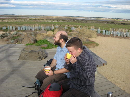
that enormous walk around melbourne, db and i went for a shorter one around laverton. you can see the route on mapmyhike.com by clicking here. you can see all the pics on my flickr.

the before shot: d&j

to be honest, before we did the walk, we weren't sure if there could be anything worth looking at in laverton! this was somewhat exacerbated by having some public transport muck-ups on the way, and the day being quite cold, overcast and windy. however, we had seen some jedis sparring at north melbourne station, and got a bus (train replacement) straight from newport to laverton, so there were already some things going for the day!

atmospheric laverton creek

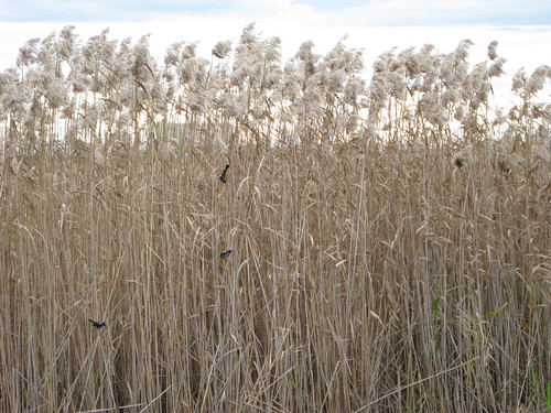
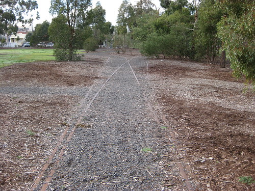
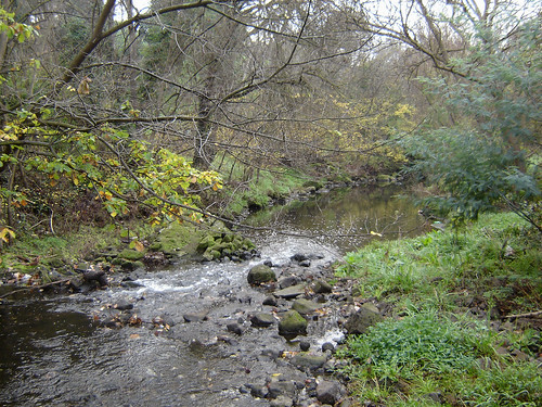
not far along the route, the creek started growing considerably, and looking more like a creek than a drain. there are a few 'proposed bridges' over the creek, but we were glad we hadn't counted on them being there, because we would have been cut off on the other side!

spoonbills on laverton creek

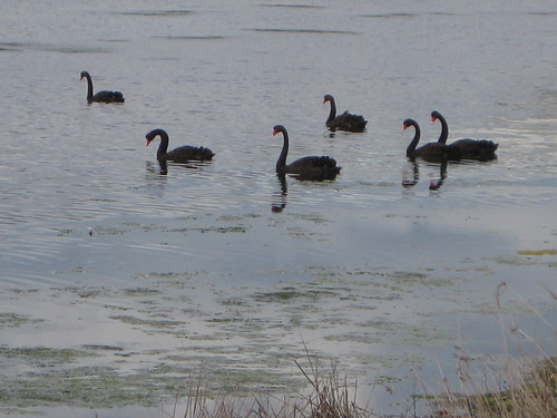
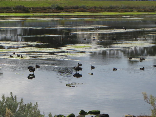
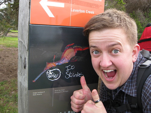
there are a lot of interesting birds to see on laverton creek and the western wetlands in general. this photo shows some spoonbills (and an imposter). SPOONBILLS! we didn't see the wee stilts that migrate seasonally between melbourne and siberia, though.

kissy kissy: d&j and laverton creek

we decided that the walk wasn't so bad after all! as a side note: the walk was very accessible to people with prams or wheelchairs, and also to cyclists.

footbridge over laverton creek

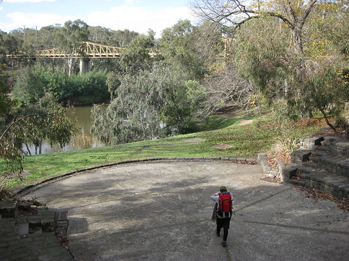
at the mouth of laverton creek you can turn north towards altona and the city, over this footbridge. if we do the walk again, we will probably take this option. however, before we do, we will make a detour to the hundred steps to federation - a rather boring park/path thing, featuring a small hill with a spectacular view.

time beacon: 100 steps of federation

this is the time beacon (by cameron robbins) at the top of the hill. standing beneath it, you can see 360degrees - the dandenong ranges and the yarra ranges across the bay, the city skyline, lerderderg and werribee gorge state parks, and the you yangs. fantastic!

sun with a skirt of stormclouds

it was a bit cold and windy, so we stopped to rest our legs for a bit, then headed south alongside cheetham wetlands to skeleton creek. along the way we saw several houses with australian flags in their back yards - lucky, because otherwise how would we have known which country we were in? we were also aided in our navigation by this sculpture near where the path intersects with skeleton creek:

sculpture near skeleton creek

it was a pretty cool sculpture, actually! however, the walk up skeleton creek was not as fun as (and it was longer than) the walk down laverton creek. we had our tea and a snack sitting on a lonely bench, puzzling over who might actually need a house as big as the new ones going up over the other side of the creek, and chasing after things the wind blew away.

j on the play equipment near skeleton creek

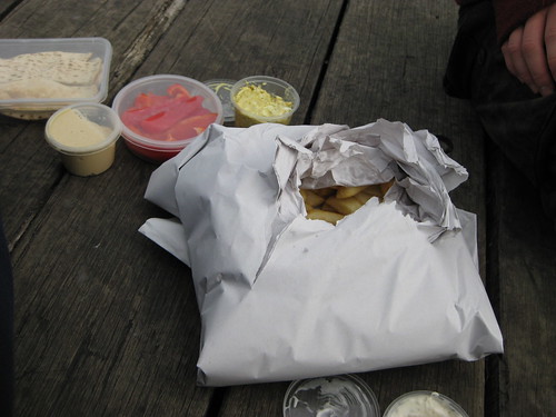
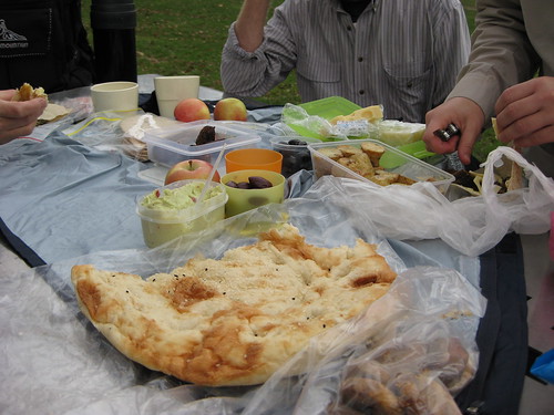
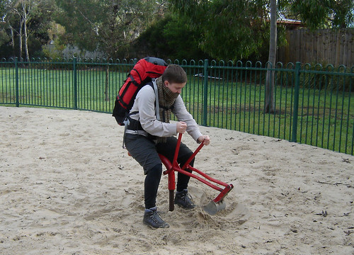
one highlight, though, was the play equipment some way up the creek. i had a bit of fun negotiating it with my pack, while d took some pics! we made our way back over the freeway and down to aircraft station, where we waited only a few minutes before the bus arrived and took us back to newport. we had arranged on a whim to see my sister for a late lunch, and she suggested yarraville, so we hopped off the train there and ate vast quantities of noodles. it was a genius end to our walk, i think!

kissy kissy!

i took my new boots for a burl, and they seemed to work well! i didn't get any blisters, or feel any rubbing, so that's a good sign. the only possible issue was that my feet might be rolling in too far (over-pronating). i have an appt with my podiatrist on tuesday, so i'll ask her about it then.

MELBOURNE'S INNER & OUTER CIRCLE RAILWAY WALK: SATURDAY 6 JUNE 2009

outer circle trail


On Saturday 6th June, I joined SJ, G, and my parents E & J for a nice long walk connecting Melbourne’s dismantled Inner Circle Railway and Outer Circle Railway. We planned to walk from Royal Park station, along Park St to Rushall station (Inner Circle), then follow Merri Creek and make our way to the Fairfield Boathouse. Then we’d cross over and walk beside the Yarra to join the Outer Circle at Chandler Hwy, walk into Kew East, and follow the Anniversary Trail down past East Camberwell and Riversdale stations to the end of the Alamein Line. From there we intended to follow the line of the old railway over Gardiners Creek and the (SE?) freeway to Malvern East station, and walk beside the track down to Oakleigh. J & E hopped on a train at [STATION], while SJ, G and I found ourselves having to make a 1km detour before Malvern East station because the footbridge over the freeway was out of service. By then it was getting dark, so we decided to call it a day. According to mapmyhike.com, we walked about 24km in the end. I can't really be bothered writing a review, so here's a picspam instead!

You can see all of my photos on my flickr.

i made little booklets!
I made booklets with information I found on a few websites, because I'm a dork. (Photo by JW)

stunt reading!
Mmm, interesting! (Photo by EW)


The highlight for me was the section between High St, Kew East and East Camberwell station (and even further on down to Burwood Station). This was partly because I’d never walked this section before, and also because J supplemented the official history (given on signs along the path) with anecdotes of his childhood and adolescence in the area. The scenery was also gorgeous, with old established European trees, lush winter-green grass and a misty grey sky lending the atmosphere of having walked into a different place or time. Here are some photos from that section:

dunning & sons
The old signal box at what was once the Kew East goods yard and is now the timber yard.


And an artier shot by SJ.


tea at my grandparents' house
Tea at my grandparents' house - it was very kind of them to host 5 stinky walkers!


j educating us about the history of the area
J telling us stories about cracker fights when he was a misbehaving youth.


under the bridge to england
"Under the bridge to England", I called this photo . . . and I think that sums it up pretty well.


sj, g & l enjoying lunch
SJ, G & E enjoying our enormous lunch! It was delicious!


Another pic of lunch, by SJ.


anniversary trail sign
They've really made a lot of effort with the Anniversary Trail. Kudos to Boroondara Council (I think its them what done it).


Now let's skip back to the first part of the walk, with some pics from between Royal Park Station and Yarra Bend Park/Fairfield Boathouse. Delicious non-linear narratives!

into the light
The bridge under Royal Pde.


"One art, please!" (Photo by SJ)


op art under the bridge
Op art under the Royal Pde bridge.


The real reason I wanted to do this walk! THIS IS MY FAVOURITE BIT OF PLAY EQUIPMENT IN MELBOURNE. (Photo by GT)


no train coming
SJ checks out a preserved piece of railway alongside Park St.


Where the old Inner Circle line continued towards Rushall (right fork) or diverged to Fitzroy (left fork). Fitzroy Station was near/in Edinburgh Gardens. (Photo by SJ)


I think this is Merri Creek? Let me know if I'm wrong! (Photo by GT)


Near Fairfield Boathhouse - that's me heading to the middle of the amphitheatre, with the pipe bridge over the Yarra in the background. (Photo by SJ)


I DON'T BELIEVE YOU, IMPOSTER PHAR LAP!
LIES, ALL LIES! At the Boathouse.


sj <3 tree
SJ: Tree fetishist? They have a name for that, you know, dendrophilia. I know this, because it's in the book SJ & E gave me for my birthday!


Gorgeous trees and light in Yarra Bend Park. (Photo by GT)


And now a couple to finish off:

eerie sky: looks like a real estate ad
As it started getting dark, the sky to the east-north-east started to turn a vivid deep blue and purple. I haven't done a thing to this photo - I just pointed and clicked.

after the war, i mean, walk
SJ, J & G: The after photo! We're on the train back into the city from Malvern East station.

9 June 2009

MAPS, MAN, MAPS!

d and i are watching map man, presented by nicholas crane. it's a pretty fun programme so far. the first episode is set in scotland, following the maps of william roy, and the second is a journey across the pennines using one of john ogilby's 'britannia' road maps. nicholas crane himself is delightfully nerdy, and gleefully enthusiastic about finding old roads, looking at stunning views, and stomping in as many puddles as he possible can. if he wasn't so appallingly FIT and HEALTHY-seeming, with an unnatural love of being COLD and WET, and a propensity to camp in inhospitable climes i would make him elope with me.


i am really interested in the evolution of maps from glorified itineraries (all the towns and rivers in order, but not to any real scale, as in the maps of matthew paris) to strip maps (like ogilby's), the different kinds of paths that made that evolution possible, and the different kinds of travel they encouraged.

5 June 2009

YAY BIRTHDAY

i bought myself* a new pair of boots! they are asolo atlantis boots (i almost got a full leather pair of raichles, but in the end the asolos were simply a better fit). i'll talk more about the boot-buying experience in another post.

asolo hiking boots

i won't wear them for the 25km walk on saturday, but i'll probably stomp around the house in them today to check they are ok or if i need to go back for a replacement pair (or if i have questions - man, bogong are the best, best, best place to buy walking boots).

i got some other walking-related gifts, too!

fuck yeah walker's pocket companion!

omg it's so me!

yay, funtimes!

* db just contributed $100 to them, so it is now a joint present! OH! and also my grandparents! thank you!