Showing posts with label review. Show all posts

31 December 2010

2010 IN 2010: COMPLETE!

some readers may remember that i had a plan to walk 2010km this year - and i hit that target three days ahead of schedule! yay! as a reward i went and bought myself a new pair of boots as the old ones are well and truly worn out! (and they were on sale, so they cost me about $300 instead of $350!)

anyway, i have written up a discussion of my experiences with the 2010 project below - feel free to skip this if it is of no interest to you!

WHAT WAS THE AIM? to walk 2010km in 2010

WHY A DISTANCE CHALLENGE? because, unlike the few years prior to 2010, i knew that i wouldn't be going on any major multi-day hikes. spending a fortnight walking 250km of the southwest coast path (swcp) in cornwall in 2009 gave me a great sense of achievement, and i wanted something to aspire to for 2010. i also vaguely thought that it might keep my walking fitness up, though not to the standard i was immediately post-swcp!

WHY THAT DISTANCE? i wanted a total that was a challenge, but doable. in the months leading up to doing the swcp, i kept a record of how many kilometres i walked every week. when i did a long walk during the week i could walk up to 48kms, while some weeks i only managed 20km. mostly, however, i seemed to walk around 30km a week. i figured, then, that i would probably easily walk 1500km in a year, so i'd need a bit more for it to be a challenge. 2500km seemed a bit too challenging (almost 7km per day!), so 2000km it was . . . plus 10km to make it match the year! approximately 5.5km per day seemed manageable.

FACTORS I CONSIDERED: i knew it was likely that the shop i worked for would close this year, and that my scholarship was going to run out, so i didn't actually know if i'd have the financial ability, time or energy to complete this project. i intended to see how i was going around july, and not be too concerned if i couldn't keep up. i was also quite concerned about summer heat and a little less concerned about winter rain keeping me off the path - both had an impact, heat more so than rain. fortunately things worked out ok in the end!

HOW I KEPT TRACK: made me a google doc spreadsheet, yay! i mapped distances using mapmyhike.com, and averaged daily totals to the closest half k (when in doubt i tended to round down, but if i did that a few days in a row i would then round up for a couple of days). i didn't use a pedometer or a GPS tracker or anything fancy like that, so my distances aren't 100% accurate, but they're good enough for me. here is the graph generated by google docs:


ON THE DAILY AVERAGE: 5.5km a day is probably a little over an hour of walking for me - provided it's on flat ground, a fairly smooth surface, i know where i'm going and i'm not stopping to take lots of photos! however, i am not in the habit of going for an hour-long stroll in the evenings/mornings for no reason: my walking tends to be commuting or a full-day leisure activity with . one thing i noticed was that there's pretty much nowhere i go that's 5.5km (or 2.75km one way, 5.5km return) from my house! two areas i frequent (one with my doctor, a supermarket, several cafes and my counsellor; the other with my chiropractor, some cafes and a library) are around 4km from home, uni is about 6-8km depending on the way i go, three of my favourite cafes are a bit under 2km away. my usual tram stop is 800m! and of course, my kitchen is 0km away, so there were many days when i did nada. i guess i'm trying to say that i actually did have to work on keeping on target, it didn't 'naturally' average out.

PROGRESS THROUGH THE YEAR: as noted, where and how much i was working and what else i was doing had an impact on my progress. so did the weather! looking at my spreadsheet, i was only ever under target in february (though i did get right down to the line on a couple of other occasions), when the heat made it difficult to get out for long walks. when i was working in retail, i didn't walk into work because (a) i didn't want to be sticky, (b) i didn't want to carry a change of clothes and (c) i had to stand up all day anyway, which is quite hard enough on ones feet! when i was doing more work at uni, i was able to walk there a couple of times a week. when i was working in november, my workplace was just under 2.5km from home, so walking there and back every day kept my average fairly consistent for the month. db and i went on two overnight walks in june and july, which helped boost my totals mid-year when rain and extra retail shifts (= very little walking for a number of days each week) threatened to put an end to my dreeeeeams (ok, it wasn't so dramatic as that). i am pleased with how on-target i stayed throughout the year.

WAS IT A CHALLENGE? yes! but, just as i'd hoped, it wasn't overly difficult and i didn't have to (nor did i want to) put a lot of pressure on myself to do it - i already had enough on my plate doing uni stuff, trying to find jobs, etc. i didn't let this become yet another thing i felt obliged to do; it was mostly just an enjoyable challenge. i could have done more, but i think anything more than 2200-2300km would have been . . . too much of an intrusion on my life. it was pretty cool and very satisfying to see the little red line on the graph creep slowly up!

WHAT I GOT OUT OF IT: although i've been walking for a few years, doing this definitely encouraged me choose to walk instead of taking public transport when the option was there (we don't have a car, i sold my bike). i feel like i'm more likely to walk now than i was a year ago, and that the decision to walk is a lot easier to make. (not that i didn't walk a lot anyway!)

i'm not sure how to describe the grounded connection i feel to the places i've walked consistently throughout the year without sounding a bit . . . romantic (as in romanticism)? and, again, many of these things were happening for me before this year, but spending so much time outside is certainly one effect of doing this project. there's a great feeling of meeting the land (or the city, or the earth, or the environment) at a one-to-one ratio when i walk rather than take a tram/bus/train/car - there's a different understanding the slope of that hill or the curve of this road, the crack in this concrete or the colours of that tree. it feels like a more considered approach. knowing the physical distances between the places where i live, work, study, play (and in fact making that distance one of the spaces in which i live my life) is like: carrying a map of the city in my body, putting myself in the map, mapping that city with my feet, mapping my body into the city, carrying the city in myself. idk. i feel . . . privileged to have seen the full year cycle in parks and gardens, to have watched houses getting built or renovated, to have seen kittens and puppies grow bigger in front yards, to have smelt the creek almost dry and in flood, to have experienced the seasons changing against my skin. i feel like i'm learning to slow down and listen to or feel for different rhythms, to be in and of the environment. (i was trying to explain this to a friend who said it sounded a bit like some buddhist practices of mindfulness, but i have no real knowledge of these things so i can't assess that call!)

i have also discovered many new places with various walking companions this year - walking from our house all the way out to warburton on six separate days, discovering darebin parklands, finally going for a(nother) walk on the maribyrnong river, doing two overnight walks in the dandenongs, figuring out a couple of new back ways through alleys and parks around town, walking from here down to st kilda, climbing mt st leonard near healesville . . . and also walking in yorkshire and london when we were in the uk in march. these are things that i might have done anyway, but having a target definitely encouraged me not to put these things off for another week or two, but to get out and do them now (or at least soon)!

2011KM IN 2011? many people have asked me this, but i think i'll have to say no! the coming year just has too many unknowns for me to set myself another target like this. i have many other projects to plan for in 2011, so i will focus on them. however, i would definitely do something like this again in the future - and if anyone is interested in doing something like it themselves, i'm more than happy to chat with you and help you set a goal!

i think i will still track my progress on a spreadsheet just for fun next year, and i will absolutely try to keep walking most days. maybe i'll do 2012 in 2012?!

6 November 2009

SOUTHWEST COAST PATH REVIEWS: ACCOMMODATION AND FOOD

We’ve been back in Australia for over three weeks, now – a longer time than we were walking the Southwest Coast Path, although it doesn’t feel like it! There’s so much to do here, it’s so familiar, and the time seems at once to fly by and not to move at all. On the trail the rhythm was so steady, so regular that after a week we felt like we’d been walking forever. Before we forget, we have written up a list of highlights and lowlights, recommendations, tips, and things for us to think about next time we do a longer walk. Here is the first section about accommodation and food.

ACCOMMODATION

We stayed in B&B accommodation every night, and were lucky not to stop anywhere extraordinarily noteworthy for its badness. The least good of a good bunch were:
Whiteways Guesthouse in Penzance. It was small, a bit noisy, and the breakfast was nothing to write home about, BUT it was also only 55 for a double, so we’re not complaining.
Housel Bay Hotel on The Lizard. This was expensive, booking and confirming was a haphazard affair, and the room wasn’t special, BUT they had a very good breakfast and a lovely view from the dining area. And a bath.
Rashleigh Arms at Charlestown. Also expensive, and we slept really badly due to the hotness and stuffiness of the room, BUT the room was luxuriously big, there was a gorgeous deep bath, the service was good and they made me a flat white for breakfast!
Jago Cottage near Portloe. Nothing at all wrong with the accommodation, though it’s a bit of a hike from the path at the end of a long day, and you might not want to stay there if you don’t speak English!

Places that stood out as being excellent were:
Copper Kettle in Porthleven. The hosts are friendly (we had conversations with people over breakfast who we kept in touch with over the walk) and knowledgable, the breakfast is good, and the packed lunch was enough to keep us going right through the day (we didn’t need dinner!). The rooms are also nice.
Honeycombe House in Mevagissey. Again, the hosts are friendly, and we had one of the balcony rooms with absolutely spectacular views over the bay and harbour. The breakfast was also nice, although you’d be hard pressed to notice given the amazing vista out the breakfast room window!
Chyavallon in Polperro. Friendly host, bright and clean room, lovely village, very delicious breakfast (strawberries and kiwifruit on the fruit platter, yum yum yum!)
Parc-an-Grouse in St Keverne. Perhaps we liked this one mostly because we stayed two nights and had a chance to explore the area – the ponds, St Keverne village and Roskilly’s icecream dairy! However, the room, food and hosts were good and there was a lazy cat and a gorgeous old dog to pat.

Best breakfasts: Chyavallon, Housel Bay Hotel, Copper Kettle, Landrivick Farm (near Helford).

FOOD AND DRINK

We ate and drank our way through a wide selection of fare – some of it excellent, some of it too hideous to finish. We ate a lot of standard pub grub which is not what you would call inspired in its vegetarian options (J is vegetarian, D is not), and there were some nights we were too exhausted to contemplate leaving the room, so we dined on the biscuits from the coffee trays. There were, however, a few non-B&B food high- and low-lights, which we feel we should share. Let’s start with those things best avoided by future walkers!
• The fish in Fowey: from the takeaway shop on the quayside, this fish was at once watery, soggy, flavourless and rubbery. It was a genuinely unpleasant experience.
• The veggie burger at St Keverne. From Three Tuns Pub, this ‘burger’ was literally a fried veggie patty between two halves of a cardboard-tasting white bun – no cheese, no sauce, no pickle, and only a few bits of salad on the side. Luckily the chips were very good and there was some live music and interesting wall hangings to take one’s mind off the burger.
• The ‘oriental’ meal in Penzance. Can’t for the life of me remember what the place was called, but the food was fairly insipid, chips were on the menu, and the other patrons seemed to be giving us the stink-eye for being a same-sex couple. Fun times.
• The cider in Polperro. From Blue Peter, this cider was The Worst Cider I Have Ever Met. It was warm and flat (as was the beer), and tasted like rancid apple juice mixed with cow urine. Coupled with the ‘hilarious’ (read: sexist/stupid) sayings on the rafters, this is possibly our worst-of-the-walk.

And now onto those places that make your day better, the ones you remember nostalgically when stuck half-way up a horrible hillside without a food source in sight at 2pm a few days later. Heh.
• The pasty in Helford. From Down by the Riverside Café, the pasty was fresh and hot, with chunky filling and a crisp pastry. The cream tea was also noteworthy, with freshly cooked scones a perfect accompaniment to a sunny afternoon. The staff were also very friendly and helpful.
• The icecream and food at Roskilly’s, St Keverne. Could it get any better than watching an icecream making demonstration then heading to the café and buying cones with huge scoops of delicious creamy goodness? Yes, it can! If you go at lunch time, you could also have a meal with nutritious soup, crispy salad, and tasty vegetarian tart (not J!) in the courtyard.
• The meal at Citrus Café in Falmouth. After however many days of walking through places where vegetarian food consists of chips and salad and maybe soup, finding Citrus Café was an event to remember. Although not all the options are veg, there were many interesting dishes, like a walnut and blue cheese salad, goats cheese tart, a tasty moussaka, and cakes, cakes, cakes! The music and ambience was also lovely and cosy, and just slightly hippie.
• The Thai meal in Plymouth. Thai Palace was literally around the corner from our final B&B, and we thought we would treat ourselves to a nice meal. And it was a fantastic meal, with a wonderful balance of flavours and textures in every dish, good customer service, and – most surprisingly for me – a selection of tasty Thai wine. I had a rose, which proved so good that I had to have another glass. This was the best meal of our walk, and also far and away the most expensive!
• The hot chocolate at Life’s a Beach café in Maenporth deserves an honourable mention. It was exactly the sugar rush we needed at the time: Hot chocolate topped with whipped cream, dotted with marshmallows (vegetarians might like to ask for them to hold the gelatine), drenched with chocolate topping and finished with chocolate shavings.

17 August 2009

TWO WALKS: MOONEE PONDS-WILLIAMSTOWN & BELGRAVE-SHERBROOKE FOREST

I have two walks to write up, and they are as different as can be!

The first is a 21km walk from Moonee Ponds station (9th of August 2009), down the Maribyrnong, around the Yarra/bay to Williamstown. This was a very flat walk on sealed paths, passing through some lovely suburban green spaces and some interesting semi-industrial sections. We lunched under the West Gate Bridge and spotted some dolphins slipping around the moored boats (although we didn't get any photos). The weather was sunny and breezy, there were heaps of people out enjoying their weekend, and we ate a second lunch of chips and cider in the rotunda at Williamstown.

we five adventurers


The second is a 10km circular walk from Belgrave station (16th of August 2009), past Puffing Billy and through Sherbrooke Forest. The walk went over the hills on unsealed paths, through bush and rainforest. It was windy in the treetops, it rained for a lot of the walk, and we had to move our picnic lunch into the (very clean, very new) toilet block in order to not get flooded out! There were very few other people out and about, although the café in Belgrave – where we had tea, coffee and cakes afterwards – was doing good business.

thumbs up! nature roxx0rz!


Both of these walks are accessible by public transport. The Moonee Ponds – Williamstown walk is serviced by several train stations, making it easy to complete the walk in shorter sections. The Belgrave and Sherbrooke Forest walk is only met at a couple of points by buses (which don’t run on Sundays), but it is easy to plan a shorter circular walk of 3 or 6 kilometres. Here are the maps:


The Moonee Ponds – Williamstown path is mostly accessible to those with wheels (mobility aides, bikes, pushers and prams), although there might be a couple of minor route alterations needed to make the walk fully accessible. For instance, we did not take the available accessible path through Yarraville Gardens, and it is not possible to access our lunch spot under the West Gate due to some unavoidable steps after the footbridge.

TRES LOW 1

footbridge over the backwash


Only small sections of the Belgrave and Sherbrooke Forest walk are accessible, and most of the path is specifically signposted and gated to prevent bikes from entering. It would be possible to walk the first 3km with a pushchair (or possibly a wheelchair), but the very start of the walk is extremely steep! The rest of the walk is mostly along narrow walking paths, and there are frequent steps. However, the picnic grounds are beautiful, can be reached by car, and have wheelchair accessible toilets.

half way up the hill!

sensitive lyrebirds


They were very different walks for different purposes. The Williamstown walk was designed to be a long walk (for training purposes), and to explore more of the western side of Melbourne. We’d wanted to walk along the Maribyrnong for ages, so it was about time! The Belgrave walk was planned in order to show some visiting UK friends (one an ex-pat) some of the gorgeous bushland that is close to Melbourne, to give them a literal breath of fresh air and a chance to see a part of the city they wouldn’t usually get to. The hills were also good practice for us for our SWCP walk!

arches under the princes highway

can you spot d?


In the interest of getting this write-up done and out there ASAP, I am now going to do a bit of a picspam of both walks, first the Williamstown one, then the Belgrave one. Please feel free to ask me questions about these walks and I will answer them. I think that’s probably a better way to spend my time rather than writing up an in-depth journal entry that only 4 or 5 people will read!

You can see our pictures of the Williamstown walk here. (I've only used ours because it's easier to upload them). You can see SJ’s hilarious photos of the walk here, and G’s fab pictures here.

You can see our pictures of the Belgrave walk here.


MOONEE PONDS AND WILLIAMSTOWN

the before shot, clockwise from left: d, sj, r, j
Clockwise from left: D, SJ, R & J. G joined us about 5km in.

maribyrnong from raleigh rd bridge
We had to turn back and go over this bridge when we discovered the footbridge was out of action.

melbourne meat trail?!
Would like to go back and explore this further.

white-faced heron beside maribyrnong river
White faced heron on the Maribyrnong

dead trolley in the river
Another native!

mazu on the maribyrnong
Mazu

seagulls and skeletons
Stony Creek Backwash

comparison: gull & elvis gull
Gull and Elvis!Gull (no idea what this bird is)

g & j act like the 4-year-olds they are
G & J making their own fun!

some dero
Mmm!

peeps at breakwater pier
Near Point Gellibrand, looking out over the bay.


BELGRAVE AND SHERBROOKE FOREST

the before pic at belgrave station
The before pic of the four of us at Belgrave station. From L-R: D, J, J & I.

tree fern track
Some of the beautiful rainforest. It was too dark and cloudy to get any really good pictures (I don’t carry a tripod!)

in our classy lunch shelter
J drying her hair under the hand dryer in our classy lunch shelter!

rain stripes 2
The rain outside the shelter! It was pissing down, but luckily once under the trees we were fine.

they don't call it the queen of tarts cafe for nothing
Delicious tart at the aptly named Queen of Tarts café.

:O :O
Another delicious tart. :O

6 August 2009

BARWON RIVER WALK: 26TH JULY 2009

I should stop leaving it so long to write up these walks. BUT I AM A BUSY PERSON, OK? Busy . . . procrastinating. And stuff.

So, on Sunday 26th July (LAST MONTH, OMG WHERE DID IT GO?) SJ drove us down to Geelong (GO CATS!) to do a walk along the Barwon River.

* Here is the map of our walk.
* Here are SJ's photos of the day.
* Here are my photos of the day.

I’ve been to Geelong a total of 3 times, I believe, and I always expect it to be more of an industrial wasteland than it is. In fact, our walk was absolutely delightful! . . . That is, once we got there – first we went hunting for a bakery, and the signs pointing to ‘shopping centre’ took us on a MERRY LITTLE JAUNT around the suburbs. Eventually we found a Brumby’s/Bakers Delight and got these amazing blueberry and white chocolate scones, which we nommed for morning tea!


Scone! Photo by SJ.


We started the walk in Fyansford, which is on the very outskirts of Geelong, and is quite attractive (at least near the river). Have some photographic evidence:

the before shot: sj, j & d at the start of the barwon river walk
The before shot!

barwon river near fyansford, geelong
Barwon River. The reflections were amazing. I mucked around with them a lot!

boardwalk around the water
A short section of boardwalk. Watch out for trolls!

white fingers pointing to the sky
Taken a bit further along the walk.


We went through the gorge, looking up at the houses high above the river. They weren’t very big. Once through the gorge, the landscape became a bit more built-up, although it still felt quite outskirts-y, rather than suburban. We got to see a bit more of the industrial heritage of the area, and learned about James Harrison (I keep wanting to type James Morrison or George Harrison!), editor of the Geelong Advertiser and The Age, and the inventor of the ice-making machine. He revolutionised the food industry! Oh my! He also has a bridge across the Barwon named after him.


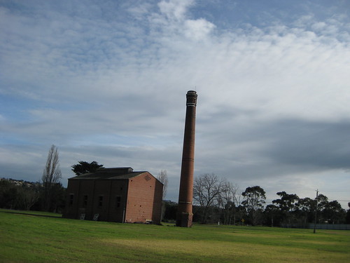
There were several of these, which I assume are old factories of some kind. Photo by SJ.


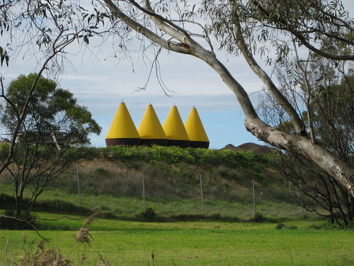
Conical things. Perhaps the book told us what these were, but I can’t remember. Photo by SJ.

this way / that way
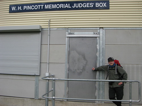
D, standing very near the place that James Harrison invented the ice-making machine!


The Barwon is also used for rowing, and we passed a few club houses. Not as fancy as the ones on the Yarra! There were also signs up and down the river informing people of when and where they could row. SJ was able to answer all our rowing-related questions: Are those signs for rowers? Yes. What’s that thing? The finish line.


J’s new house, on the finish line. Photo by SJ


In case you hadn’t realised, this area is the ROWING AREA, OK? Photo by SJ

barwon river triangles
You can see the signs for rowing on the bridge. There were some pretty good bridges on this walk. Not that I’m a pervy bridge fancier or anything.


Anyway, the weather was pretty good to us. It was sunny in parts, cloudy in others. There was a bit of wind at times, but generally it was just a breeze to cool us down. We’d been threatened with “developing showers” by the bureau, but weren’t really affected by rain. This section about the weather here is to disguise the fact that most of the pictures between now and lunch are kind of boring! Have some pictures of spring-in-July!

pink blossoms
Pink blossoms

spring willow
Green willow


We eventually stopped for lunch at a little platform just off the path, down beside the river. Lunch was rolls stuffed with hummous, semi-dried tomato, rocket, boiled egg and roast potato. Delicious!


It was delightful! We wanted to stay a long time . . . so we did! Photo by SJ

sj: thumbs up, toes in
SJ and J did the sensible thing, discarding shoes and socks and dabbling toes in the really extraordinarily cold water. Genius!

lunch!!!
Lunch! NOM NOM NOM!


Immediately after lunch we passed the LOG CLEVERLY CARVED TO LOOK LIKE A SNAKE! There was a whole bunch of hilarious community craft and art along the walk, and our book seemed quite taken with it. We thought we’d get into the mood, and a lot of my photos of this section of the walk are rather silly.

it's a log, cleverly carved to resemble a snake!
It’s a log! Cleverly carved to resemble a snake!

the third sign: quidditch playing here
Quidditch playing welcome in this park!

(Oh, also, for the record, half the public toilets on this side of the river were CLOSED AND LOCKED. Just FYI. You might want to relieve yourself when you can, even if you don’t think it’s strictly necessary!)

1:48 on the sundial
A very specific sundial! (They are BIG on mosaics in Geelong!)


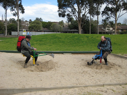
J and D play competitive digging! These diggers were pretty good. The fact that there are two makes for double awesome!


Now, at the end of the walk (as you can see if you check out the map) there was a 1km-each-way detour to visit some falls. Surprisingly, we all still felt pretty good at this point, so we didn’t even really consider skipping it. And I’m really glad we went! Because this was a lovely treat to save til near the end: the falls were lovely, but even better was the old paper mill on the opposite side of the river. It closed in 1927, and the aqueduct running around the side is a little broken in one place, creating its own waterfall.

bunyip falls (?) barwon river
The falls. We couldn’t be arsed walking all the way around and down to the bottom, so we sat at the lookout instead. We passed a family on their way down – one of the kids had fallen in. Whoops!

old paper mill beside the river
The old paper mill. People were climbing on it. It made me feel slightly ill.


We decided that it would be a lovely day out with a bunch of friends, even people who didn’t like walking. We could have a lovely picnic and explore the falls and look at the mill and dip our toes in the swimming hole . . . we had a bit of extra time to think about this, as our guidebook didn’t give us very good directions for the last leg. Luckily, we are all quite sensible and made our way back to the car in one piece.

aftershot aftershock 2
The after shot!


I was personally a little surprised when I came home and mapped the walk – I didn’t feel like I’d walked 21km. In fact, it didn’t even feel as long as the Mordialloc-Carrum walk a fortnight previously. I think this may be due in part to it being new territory, and also to leaving morning tea and lunch to a bit later in the walk, making the last leg shorter. It probably also helped that we had such a leisurely lunch stop in such a nice location; it really broke up the walk nicely.

All in all, this is a lovely walk, and I recommend it. You can make it shorter by crossing the river at one of the earlier bridges (at the 2km, 4km or 6km mark) or by simply walking to the falls (this part is not wheelchair accessible, though).

28 May 2009

OLINDA: 14KM NATIONAL PARK AND ARBORETUM WALK

On Sunday 24th May, we walked at Olinda, through the Dandenong Ranges National Park and the RJ Hamer Arboretum. You can see the map by clicking here. It was SJ’s birthday present to herself: a triumphant return to conquer the Walk o’ Doom!


View from the start of the walk, 9:30am.


Me and DB give this the thumbs up already! (Photo by SJ)


The route follows unsealed tracks and unsealed footpaths, it includes some steep ascents and descents. Although it is only 14km long, I would rate it as one of the more difficult walks we’ve done. This is mainly due to the constant climbing/descending: there is very little distance covered over flat ground. It is also to do with walking on bush tracks and footpaths, which are often uneven, slippery with wet leaves, or obstructed by fallen branches and overhanging foliage – it takes a lot of mental energy to continuously pay attention to where you’re walking. I slipped over at the start of the walk, landing on my bum and pack (good reason to have a nice big pack, to buffer the landing) jarring my shoulder and bruising my hand. Going down steep hills is hard!


I think this was just before I fell over! (Photo by SJ)


Board track, beside the grounds of Silvan Reservoir


The other reason I’d rate this harder than average is that the Melways maps, the maps from Parks Victoria and Google Maps often don’t match up, or show conflicting information, thus some small amount of navigational skill is needed to route find. For what it’s worth, if you are going with one map only, I’d use the Parks Victoria one because although it doesn’t show all the tracks, the ones it does show are in the right places. I love maps.


Yes, I do like maps! (Photo by SJ)


We crossed paths with two or three small groups of bushwalkers, and amused ourselves by talking about feral park rangers turned cannibal jumping out and attacking bushwalkers with chainsaws. THAT WAS FUN. We also talked about how if you were going to eat a member of your party, you would totally start with their arms, so they could still walk. Ummm . . . *shifty eyes* WE'RE NOT REALLY THAT CREEPY, I SWEAR! OK, maybe a bit. Anyway! We saw a shitload of bikers going down hills at top speed. That way lies broken collarbones, people! DON'T DO IT! We also gave directions to a couple of chaps who were strolling around clutching bottles of beer - we knew we were getting close to the end when we started seeing people in jeans walking around! However, for the most part this was a gloriously quiet walk, with just us, the trees, the ferns, the birds and the water to make noise.


DB with a tall tree


Last time we walked here, we were absolutely knackered at the end, and went to E’s mum’s place and fell asleep on the couch! This time we did a longer route (14km instead of about 11km), and I think we avoided the very steepest section of last time. Mind you, it was still rather steep in parts!


Note the sweat! It was pretty steep!


We definitely noticed an improvement in our endurance and recovery, though, because this time we were not completely wiped out, and in fact still had the energy to sing Beatles songs at the top of our lungs (substituting lyrics to make them even creepier than they are) on the way home. It’s nice to know that we’re getting better, especially as D & I were carrying our big packs this time (full of phone books!)


D & SJ heading uphill after lunch.


In conclusion, this walk is highly recommended, especially in autumn as the leaves from the deciduous trees in the arboretum are changing and falling (I’d suggest April-May as a guide). It is lovely to see the contrasts between the drier bush, the rainforest in the creeks and the European/Asian/American trees on the slopes. This walk has gorgeous views at the start and also climbing out of the valley at the end, and gives a great sense of accomplishment to complete.


View back over walk and valley (Photo by SJ)


View back over the arboretum and national park


I would recommend a shorter walk (down to Valley Picnic Ground and back, or a less steep route involving driving to the bottom of the valley) to people who don’t have a moderate level of fitness. You need to take ample food and drinking water, as none of the water en route is potable. There are BBQ and toilet facilities at the start/end and at Valley Picnic Ground. The walk is not PT accessible, and is not wheelchair, scooter or pram accessible.


SUCCESS! Us at the end of the walk!


More of my photos can be found by clicking here.

SJ’s new camera can be seen in action by clicking here.

Happy birthday, SJ!