1 July 2010

WALKING OUT OF THE CITY: DAY THREE

Tuesday 15 June 2010
Eltham to Ringwood
24km / Approx 7 hours
Map


Having recently walked for miles in the bush of the Dandenong Ranges National Park, I was prepared to be disappointed with this walk – I was half-expecting it to run through housing developments, with the Mullum Mullum Creek resembling the concrete-drain sections of Moonee Ponds Creek. Not, I hasten to add, that this would be a bad thing, just that I think I secretly wanted my walk out of the city to have a neat progression from urban to rural, and I expected this section to defy my preconceived narrative needs! . . . It did – but, delightfully, not in the ways I anticipated. For example, I did not expect to walk past a group of kangaroos just after the confluence of the Mullum Mullum and the Yarra, I didn’t expect the stretch of the creek down to Tindals Road to be quite so forested, I didn’t expect the roadside walking to be quite so hilly and quite so nerve-wracking (no footpaths!), I didn’t expect the 100 Acres reserve to feel so ‘natural’ and so large. I certainly didn’t expect what we saw of Ringwood to be so unlike the Ringwood I’d built in my mind – the freeway, Maroondah Highway, Eastland and the railway station were packed together within a kilometre at the end of the walk, and what we saw of the rest of the suburb was full of quiet courts and leafy streets, with unexpected views of the Dandenongs as we turned a corner or topped a rise.

SUDDENLY MOUNT DANDENONG!
Getting closer to the Dandenongs - it feels like we're really making progress!


One thing that I really enjoy about walking is the real physical connection it produces with the surrounding landscape, and the way it can invite a re-think of the way in which our environments are structured and imagined. I’ve been paying particular attention to the ‘feeling’ of the places we’ve been passing through on this walk out of the city and asking myself why they feel the way they do. Is this spot easily defined as part of one council or another? How do we conceptualise these kinds of boundaries? What kinds of buildings are there – flats or apartments, houses, light industrial – how old are they, and how big are the blocks of land? Are there other people around, and, if so, what are they doing? How does the presence of a river or creek change the feeling of a place? What can I see from here, and (sometimes more importantly) what can’t I see? Which sounds and smells are dominant? Are there signs of birds or domestic animals? Am I reassessing my ideas about this suburb (Ringwood!) or place, or even about the city itself?

machinery returning to nature
Unexpected tractor carcass, making me wonder exactly how far from the city we were!


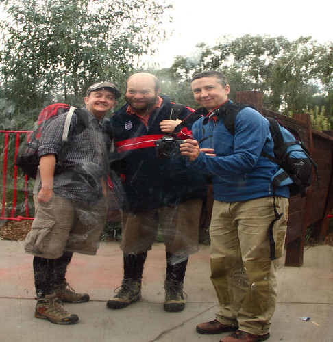
We started in Eltham, and I grabbed a coffee before we set off along Diamond Creek. This area is beginning to seem quite familiar, even though this is really only the third time we've walked here. I remember feeling similarly about Belgrave the third or fourth time we headed out to walk in Sherbrooke Forest, and it makes me wonder how long it takes other people to feel familiar with a place? Not to know it in that way that only really comes with years of treading the same paths (and even then, perhaps the longer you walk in one place the more variable and unpredictable and different it might become - I couldn't say for sure!), but just to get that comfortable feeling of, "Oh yes, here I am again".

Old fire bell, Eltham CFA
I got a couple of shots of the old CFA bell this time.

Smith, Phillips & Dawson bell, Eltham CFA
You can read more about it here.


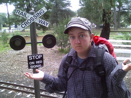
We trundled off past the (full size) trestle bridge and over the miniature train tracks down to the Yarra, and crossed at the footbridge. From there we turned left, heading along the boardwalk into completely new territory (for us). Not only was it a new path, but we'd forgotten to bring our map! Again! Considering how prepared we like to be, and considering my slight obsession with cartography, this walk out of the city has so far been almost map-less. I recited what I could remember to D, and drew up a sketch map from memory, and we decided that our first tactic would be to ask people for directions, and our second would be to consult Google Maps on D's phone (if we could get it to work). There is something both freeing and constrictive about not having a map, I find: in some ways it really encourages a closer connection to the physical elements of walking (the topography, the roads and signs on the way, your body's own way of measuring distances and times) and with other people (asking for directions, for example), whilst also averting the mundaneness of knowing exactly where you are on (what in this case would be) the familiar grid of the Melways; in other ways it means not having the ability to change your route, to head down a path with the knowledge that it will eventually join up to the route you'd planned (on a 24km walk I really don't want to come to a dead-end some half an hour down the track), to get a wider impression of the area in which you're walking (what suburb you're in, what's going on over that hill just there). There are things to recommend both options!

j gives this bridge (and this coffee) thumbs up
Thumbs up to the bridge and the coffee!

dan waits to cross at the miniature railway in eltham
D waiting to cross.

WILLIAM G PERT RAILWAY WORKSHOPS
Miniature railway workshops and turntable thingy! (What are they called?!)

yarra from the footbridge near diamond creek
Yarra from the footbridge near Diamond Creek.


The path takes you between the Yarra and a large (organic?) apple orchard - another thing we'd never have realised was there had we not walked past it - which apparently has an organic fruit and veg market on Fridays and Saturdays (read more here). You curve around southeast to the confluence of the Yarra and the Mullum Mullum, where an information sign tells you some of the history of the place - particularly its significance to local indigenous people. Across the creek stands Pontville Homestead, Victoria's oldest pioneering residence still on its original site, and it might be a place to go back and explore later. Just a few minutes further down the track in Tikalara Park we stopped a jogger and asked for directions . . . and then noticed a mob of kangaroos lounging beside the creek! If it weren't for the pylons marching to converge upon the power station, we could almost have been on the outskirts of a country town rather than less than two hours walk from the met train. Another kilometre took us to Beasley's Nursery and Teahouse which we visited mainly for the toilet, though we ended up sitting at one of the mosaic-topped tables and having a drink because it was so inviting!

blue tractor at petty's orchard
Tractor at Petty's Orchard. I thought my dad might like this one!

Pontville Homestead
Pontville Homestead.

kangaroos (i think) in tikalara park
Kangaroos!

a pylon moot
Pylons!

mosaic ducks at beasley's nursery
Our table at Beasley's Nursery


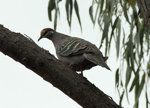
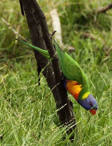
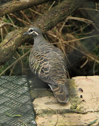
The next few kilometres were extremely pleasant. We were very much in the swing of things, and the Mullum Mullum trail was easy to follow. We watched cockatoos flying through the treetops, saw a flock of rosellas or parrots or something hanging out on one verandah taking turns in the bird bath, passed a small group of people quietly planting grasses and shrubs beside the path (my guess is Friends of Mullum Mullum Valley, stopped for lunch at a well-placed picnic table. I'd imagined that this section was going to be much more like an inner-suburban creek: nice, but closely hemmed in by houses. The houses were there, for sure, but it felt a lot less suburban. Unfortunately for you, dear reader, we were so busy enjoying ourselves that we forgot to take many photos!

HAVE YOU SEEN A KOALA TODAY?
Nope, only kangaroos.

d taking a business call
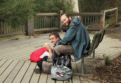
D at our lunch spot - not at work, but they still call him!


The next section, though, was very different, and I want to take a moment to consider some of those differences. Often, I read promoters of walking saying that it's the easiest and cheapest and most accessible and environmentally friendly way of getting around or spending your leisure time or getting some exercise, and it's easy to agree. I only have to step out of my house onto an even pavement, walk a couple of minutes to the smooth bike track beside the Merri Creek, stroll down the alleyways . . . it's easy, cheap, accessible, no-carbon. Now, when I planned this route, I consulted the Melways and Google Maps (on mapmyhike.com) to trace the greenest route I could find between Eltham and Ringwood stations, but even so I knew there was going to be a couple of long sections of road-side walking. Noting that most of this was going to be in areas with a significant amount of housing – big blocks, I thought, but not exactly uncivilised – I think I assumed that there would be either sealed footpaths or informal paths alongside most of the streets. After all, it's still the city! I was wrong. Between Mullum Mullum Creek and the 100 Acres there were small stretches on unsealed tracks off the road, but most of the time we were walking on the shoulder of the road, crossing before blind corners in order to stay as safely visible as possible, backtracking and scrambling up and down cuttings to avoid dangerous bends, traipsing through weeds and grass, and picking our way along the gutters and drains.

As we made our way along Stintons Road, constantly alert for traffic, I thought again about the meaning of 'easy', and for whom and in what circumstances walking is 'accessible'. D and I agreed that this part of the walk was actually not too bad - it was interesting, there were good views, and we felt rather intrepid. But – and this is key – this is only because we are relatively fit, mobile and able-bodied, and probably also because we were determined to get to our destination (where else would we go?) by foot (because we didn’t really have another option). It is a somewhat ironic state of affairs. There we were in lush green surroundings with views over rolling hills, smatterings of bush, paddocks with horses, fresh(er) air and the sound of birds calling . . . and it was almost completely inaccessible to anyone who was not in/on a motor vehicle (cycling would also be nervewracking in some parts of this route) or who wasn’t a landowner. It was certainly not accessible to people in wheelchairs, or to anyone pushing a pram. I don’t want this post to turn into a rant or get completely bogged down in a discussion about the politics of land ownership and urban planning, but I think this is something of a paradox: people tend to think of the freedom of being out of the city, but sometimes as we get further from the city, the environment actually becomes more restrictive.

somewhere warrandyte/park orchards-ish
View from the roadside.

PLACE OF LAST RESORT!!!
This amused me!


Eventually we reached the 100 Acres reserve (not the Hundred Acre Wood!), snapping a photo of the map on the information sign before we plunged in. The 100 Acres apparently used to be orchards, before the military purchased it early last century. Since the end of the second world war (I think), it has been left to re-vegetate, and it is now a public reserve. It is a really lovely spot, big enough to spend a couple of hours exploring without retracing your steps, but small enough that it would be difficult to get lost. We had a cup of tea on one of the benches scattered around the place before heading out onto Berringa Road.

white heath (Epacris impressa, I think)
Epacris impressa, I think? The white version of Pink Heath that is Victoria's floral emblem?

slightly sinking sun
In the 100 Acres reserve.

d makes tea
Time for tea!


From here, it should have been an almost straight walk south to Ringwood Station, but a wrong turn sent us on a detour, adding a kilometre or so to the distance. Luckily we weren't too pressed for time, so we enjoyed having a stickybeak at the surprisingly peaceful and attractive part of Ringwood (even if we did have to climb a hill!). All too soon - and it felt quite sudden indeed - we were crossing the freeway, passing Eastland shopping centre, and heading into the station. It was a bit of a shock after such a rural-feeling meander through suburbs that could hardly be described as suburban to find ourselves back in the thick of things.

The Freeway
A lot of people choosing driving over walking or riding . . . but considering how far it is between stations, I'm not sure I blame them.

EASTLAND (or EASTLANDS if you want to make it sound like NORFLANDS)
Eastlandsss!


It took us some time to get home on the train and tram, watching the fiery sunset and dozing off. It is actually rather satisfying to think that we have walked all this distance, that we are getting somewhere, wherever that might be . . .

j & d in the 100 acres flora and fauna reserve
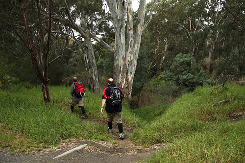
Us in the 100 Acres reserve


And tomorrow we are heading out to do the next leg - a section that will bring us almost to the foot of the Dandenongs!

27 June 2010

HALF WAY

Today I (nix) passed the 1000km mark in my aim to walk 2010km this year. In fact, I am now sitting on 1003km, so I'm almost exactly half way, and 4 days ahead of schedule!

20 June 2010

SOME THINGS I LIKE ABOUT WINTER IN MELBOURNE

* The delicate, fine drizzle that wafts through the air, catching on my woollen jumper and making it look like it's covered in tiny glass beads, and sitting on my eyelashes making it look like faeries dancing when I blink.

* People wear excellent tights! All kinds of patterns and textures.

* Snuggling up in bed under the doona. When the night time temperatures don't drop below, say, 13 degrees it is just not cold enough to cuddle all night!

* The way the tops of the buildings in the city smudge and disappear into the clouds. I like to imagine that there's a whole sunny world up there, with sparkly unicorns and such . . . or else that they've been erased by a giant rubber, or engulfed by nothingness.

* It's cold enough to wear winter coats, or at least jumpers! Or to wear my shirt sleeves down and a vest over the top.

* The grass is green, gardens are growing, the creeks are flowing.

* While on some days it's just stratus, stratus, stratus, there can be some excellent cloudspotting opportunities.

* Puddles!

* Hail!

* Drinking peaty whisky (or a hot toddy!) at my favourite pub.

* Curling up in front of the heater with the sound of rain outside.

14 June 2010

YESTERDAY, LAST WEEKEND, IT'S ALL TIME TO ME

Sorry! I meant to get back to this blog sooner with photos and stories of our adventures in the Dandenongs, but life happened (as did a cold, yuck) and so it's a week later and I'm only just posting! Anyway, we had a fantastic time. You can see all our pics here, or you can look at photos just from the Saturday here or the Sunday here. We'd planned to do all of this, but we decided to cut the second day short and go home for hot baths and curry. Instead this is the route we ended up taking.

My parents visited for my birthday, so they kindly drove us out to the starting point at Kalorama and joined us for the first stretch up to the cafe/observatory at the top of Mount Dandenong. It got our blood pumping, as it was quite steep in places. Our maps also failed us slightly, which didn't exactly surprise us (since when has the Melways been accurate for walkers?), but we hoped that it wasn't the first sign of disaster! The air was cold, and the clouds were closing in around us lending a very atmospheric mist to the trees. There weren't many people out and about, but we did see a number of robins - both white-capped or scarlet robins and some variety of yellow robins.

d, j, j & e: the before picture!
Us and my parents in Kalorama Park, before we had to climb any hills!

the view from kalorama park
The view to Silvan Reservoir (we think) from Kalorama Park.

d strikes out ahead
D heads into the mist . . . with the map!

cheeky!
E on the slopes of Mount Dandenong.

autumn sunshine
The sun breaks through for a minute! We stood here and watched a number of robins flitting about.


From the top of Mount Dandenong you can see right back over the city, and it's an amazing view. Or so I'm told! We could only see clouds, clouds and more clouds. It was a little bit like being in an aeroplane, in fact! We stopped at the cafe and had hot chocolates and coffees alongside the half a dozen cyclists that appear to be the regular clientele. As we were sitting outside, the cloud rolled in around us - we could see it moving - so we beat a hasty retreat to the warm and comforting interior! After morning tea, E&J headed back to the car, while D and I continued on our way.


Video: The cloud encroaching on the cafe at the top of Mount Dandenong.

the view you have on a clear day
The view from the top is meant to be spectacular... this was our view!

latitude & longitude at mt dandenong, 2069 feet
Latitude and longitude: trig point in the cafe!

d in the giant's chair
D on the giant's chair - click through for more info.


We immediately 'lost' the path. I have no idea what we did wrong, only that the map in no way matched what was on the ground. In the end we had to guess where we were in accordance to the border between private and state forest marked on the map with a change in shading and on the ground with a barbed wire fence. We bushbashed our way down the hillside until we found the track we (hoped we) were meant to be on! Auspicious. We soon passed the cairn marking the 1938 Kyeema crash site, and paused a bit later to take in the marvellous view (we could just make out some of it through the mist). And then . . . the transmission towers! They occupy a slightly mythical status in my mind - I often judge how clear a day is by whether I can see them on the top of the mountain on the horizon, and use them as a kind of compass point. They're like the pointer stars for the Southern Cross or something! Anyway, we couldn't see our house from there, but the towers looked quite excellent fading away into the mist above us.

identify this fungus! (1)
At least getting off the beaten track (even inadvertantly) gives you the opportunity to see more flora.

kyeema crash site
Kyeema crash site.

view over melbourne
The view!

transmission tower in the mist
First glimpse of the tower/s.

get an eyeful... (*groan*)
Like reaching the end of a rainbow or something.


From there, we headed downhill, and downhill, and downhill. Well, I guess that we had been at the highest point in Greater Melbourne, so that was really the only way to go! We enjoyed the solitude, the tall trees, the tree ferns, the sound of rain and of birds calling and scratching through the undergrowth. After a while, we made it to the Doongalla Homestead site where we decided we might as well break for lunch. Doongalla history bite:
A homestead was built on this picnic ground in 1908 as 'Invermay' and later renamed 'Doongalla'. It was destroyed by a 1932 bushfire although the servant's quarters and stables remain. Later owners continued to log the forest until the government bought back the estate in 1950 and it was declared a reserve. (source)

It was lucky we had lunch when we did, because just as we were finishing we heard a whooshing sound sweeping towards us, and the rain began to pelt down, sending the young family across the picnic ground running for shelter. We shrugged, donned our raincoats, and set off with the air of seasoned walkers.

the track down the mountain
Down off the mountains...

candle flames
... to the Doongalla homestead site.

camellia (?) at doongalla homestead site
Camellias in bloom outside the Doongalla toilet block!


The rain stop-started for a bit, and settled into a light drizzle as we slogged our way up Dodds Track. By the time we'd reached the top of the hill (this was only the 8km mark - without adding kms for ascent/descent - but it felt like we'd been walking a lot longer than that!) the drizzle had retreated into cloud once more and we were treated to the eerie sight of charcoal-trunked trees looming out of the fog. The next section of the walk was relatively easy . . . which was just as well, as we missed a turn-off a kilometre or so later, and walked the wrong way for about a quarter of an hour! By the time we retraced our steps past a wee farm with the goats and chooks, the rain had started up again, and I was in desperate need of a cup of tea. We quick-marched (by which I mean 'trudged') into Sassafras and plonked ourselves onto the tiny sheltered space in front of the hall, dislodging a few cyclists in the process. The cup of tea was excellent!

j & d after lunch
A break in the rain after lunch.

fuuuuuuuuuuuuuu... dodds track, i think this was.
D on Dodds Trk - not only was it steep, it was muddy and slippery, and half washed away.

reminds me of joan phipson's "the cats"
Mist on Bradley Track.

eerie - mist and burnt trees
A recent fuel-reduction burn left the scent of charcoal hanging in the mist.

it's gonna get you!
A somewhat scary tree!

j: definitely time for tea!
GIVE. ME. TEA.


At Sassafras, we joined the Sassafras Creek Trail, dropping down into the gully as dark clouds drew in and the light began to fade - and it was only 3 o'clock! The trail is marked on Google maps, which is usually an indication that it is a fairly well-used path and often means that it is a paved bike path, so we were expecting a not-very-track walk, probably just to the side of The Crescent/Sassafras Creek Road. Well, as we later found out when talking to a university student tracking small mammals in the area, the path is well used - by creatures, and also by the Oxfam walk participants/masochists. However, it is in no way the path we were expecting. Instead, it is a lovely single-file track that takes you deep into the gully, skirting the edges of the creek. It is also a great place to fill your walking boots with water on a rainy day! I hadn't thought to don my waterproof trousers, and the narrow path meant that my legs were constantly brushing water off the bracken and other low-lying vegetation, creating a waterfall into my shoes.

It was absolutely pouring with rain, and the sky was getting very dark as we decided to abandon the creek trail and pick our way along the shoulder of Monbulk Rd (FYI, there is no footpath on the side - it might be better to stick to the creek). By the time we reached our B&B we were absolutely drenched, and extremely thankful to find our room equipped with a good heater, an iron and a hairdryer (as well as a kitchen, couch, hot shower, and comfy bed) so we could spend the evening drinking our bottle of wine, watching TV, and attempting to dry out our belongings.

We decided that it had been an excellent and very memorable day!

three of hearts
On the way down into Sassafras Creek - this is one of the last pics I took before it got too dark!

castle stone inn
Our B&B, Castle Stone Inn, the following morning. Recommended.


On Sunday morning we woke up to find that - hooray! - most of our things were dry, or only very slightly damp. The arrangement at this B&B was that we were given all the ingredients for breakfast and we got to make it for ourselves in the little kitchen. So, for breakfast we had toast with vegemite and cheesy scrambled eggs with mushrooms, tomatoes and spinach. Yum. We packed up, settled the bill and headed out - this time, I was wearing my waterproof trousers from the beginning, even if it wasn't really raining!

j & d at the start of the second day
The start of the second day.

monbulk rd, sunday morning
Monbulk Rd after rain. I was all turned about after walking so long in the dark, and it took me a long time to get my head around which way was east!


Our first map-related incident occurred only a few minutes later, when we discovered that Hillandale Road is not actually a road at all, but a ragged strip of grass between two properties at one point, and an apparently private driveway at another. Undaunted, and armed with naively puzzled expressions and friendly greetings for the neighbours, we walked its entire length anyway, and emerged into The Patch. The Patch has to be one of the loveliest little areas in Melbourne, and autumn (late as it was this year) is a wonderful time to admire its colours and rolling hillsides.

white heath? not sure what this is...
White heath? I think?

the patch / kallista
Horse grazing, The Patch.

autumn leaves, the patch
I love how these leaves fall flat on their faces, with their little stalk-tails poking in the air.


We cut through the park, past a tree full of black cockies, around the edge of the school, and then . . . DUN-DUNNNNNN! Allow me to quote from the blurb on one of the photos I took:
this was an amazing, slightly worrying and VERY STEEP section of the walk! don't believe what google maps says, crerar rd and ward rd don't really exist as anything but shrub and tree filled 'gaps'; between private properties! we wondered if we were trespassing, but it looked like a few people had walked the way we did, so we decided we'd just push through and hope we could make it to the main road! these goats and alpacas joined us (albeit on the other side of the fence), and we thought they were either waiting for us to feed them or waiting us to fall into their dastardly trap so they could eat US! *gasp* ... anyway, yes, this was a very steep hill, and we had to take numerous breaks to admire the view. fortunately, the view was very admirable!

I've had a poke around the internet, and the only mention I can find of what the deal is with these 'roads' comes from the Victoria Government Gazette No. 123, 31 October 1984.

SHIRE OF SHERBROOKE PLANNING SCHEME 1979 (RURAL AREAS)


Notice that an Amendment has been Prepared and is Available for Inspection: Amendment No. 23—1984

Notice is hereby given that the Shire of Sherbrooke in pursuance of its powers under the Town and Country Planning Act 1961 has prepared an amendment for the purpose of: Creating a new zone in the planning scheme ordinance entitled Special Restructure Zone.

Rezoning to Special Restructure Zone the following areas:
Lots 33-37, 53-57, L.P. 5809, Boundary Road/Benson Street, Emerald.
Pt. C.A.'s 1, 2 & 3, Parish of Monbulk, KaHista[sic]-Emerald Road/Crerar Road/Ward Road, The Patch.
Lots 86-89, L.P. 10708 and Lot 1, 22288, Belgrave-Gembrook Road, Menzies Creek.
Pt. C.A. 39, Section H, Parish of Monbulk, The Patch Road, The Patch.
Pt. C.A. 10, Section A, Parish of Narrée Worran, Grantulla Road/Jacksons Hill Road, Kallista.

A copy of the amendment has been deposited at the Shire Office, Glenfern Road, Upwey and at the Office of the Ministry of Planning and Environment (Plan Inspection Section), 5th Floor, 235 Queen Street, Melbourne and will be open for inspection during office hours by any person free of charge.

Any persons affected by the amendment are required to set forth in writing any submission they wish to make with respect to the amendment addressed to the Shire Secretary, Shire of Sherbrooke, Glenfern Road, Upwey by 1 December 1984 and state whether you wish to be heard in respect of your submission.

5310 K. E. MATSON, General Manager

Also, the Yarra Ranges Planning Scheme tells me that there is a "Restructure Plan for Old and Inappropriate Subdivisions in the Yarra Ranges Shire, August 2008". Any thoughts, land and property experts?

perfect mushroom #174
Another mushroom that DB wouldn't let me eat!

the patch in autumn
View from Ward Rd, near Crerar Rd. Don't be fooled - it's steeper than it looks!


And then it started to rain. Despite our map, we made it to the main road (up someone's driveway!) and into Sherbrooke Forest. It was like being on home turf again - we've walked here lots of times - and it was with a mixture of relief and a small sense of anti-climax that we dove into the bush along (FINALLY) a well-signposted track. (I have no idea why Sherbrooke manages to be so well signposted when the rest of the national park is so poorly signed!) It was around about here when we looked at each other and decided that getting home before 8pm and having time to laze around for the last few hours of the weekend was a more appealing option than walking another 10km in potentially nasty weather. We stopped for a hot chocolate at Grants Picnic Ground (where the cockies, rosellas and galahs were in full attendance), with half a mind to continue if the weather cleared. It didn't, so we struck off along Coles Ridge Rd (for some reason I am inordinately fond of that road - it's so lovely) and headed down to Belgrave, just in time to see Puffing Billy leave the station.

sherbrooke forest in mist and rain
Sherbrooke Forest in the mist and rain.

sulphur crested cockatoo tree
The little-known Lesser Cockatoo Tree, a very rare species.


And then the sun came out.

d in belgrave


We grinned wryly, went and ate a tart at the Queen of Tarts cafe, then hopped on a train and headed back into the city. That evening after our baths we ate delicious curry and decided that this was an excellent end to an excellent weekend.

A+, Would walk again!

3 June 2010

2 THINGS

1. We're going out to the Dandenongs on the weekend for 2 days of walking (present to myself for my birthday)! Yay! Here's a map of the route we plan to walk and here's the lol!B&B where we're staying on Saturday night. Looking forward to it!

2. Here's a cool article about walking from the mainland of the Netherlands to Ameland. We stayed on Ameland with my family in early January 2009, and it was lovely, but I can't imagine doing this walk at that time of year, with all the ice we could see in the water! Maybe we'll get to Ameland again one day and do this...

11 May 2010

WALKING OUT OF THE CITY: DAY TWO

Friday 7 May 2010
Heidelberg to Eltham
16km / Approx 4½ hours
Map


The path from Heidelberg to Eltham is very green (or at least, it is very green on a sometimes-sunny day at this time of the year after a few weeks of scattered rain – we’ve also walked here when it’s been very hot and yellow and brown, and when it’s been grey and pelting with rain!). In fact, one of the things that made this day of our walk out of the city so different from day one is that, barring the first and last couple of kilometres, the path barely encounters a street or vehicle track, let alone a freeway. At one point, about an hour into the walk, I turned a full circle and could see nothing but the trees, the sky, the river and G and D on the path ahead. I wondered if this would happen again at any point on this route. I also wondered whether, despite being within easy reach of the Hurstbridge train line, this is as out of the city as one can get while still being within the boundaries of Greater Melbourne?


Meet your hosts: J, D & G


And anyway, I thought, what is it about walking out of the city that attracts me? Why walk out of the city? Perhaps this question implies two others. The first is “Why walk anywhere?” and in briefly answering this, I could say that I have the physical ability, the walking space/path, access to that space/path, the time in which to walk, the social freedom to walk there, and the desire to walk. Perhaps I will return to a fuller exploration of these elements in a later post. The second question is, “Why not walk into the city rather than out of it?” and my answer is twofold.

I have nothing against walking into or towards the city, and in fact I do so frequently: for meetings, for uni, to see films, to meet people for food or coffee. However, to me, walking into the city means having a definite destination, one confined to perhaps a mile radius from the intersection of Bourke and Swanston Streets. Once you are there, you are there: there is no further aim. In contrast, if you start at the intersection of Bourke and Swanston Streets and set a course in any direction, you will eventually find yourself either on the edge of, or walking beyond, the city. Once there (should you wish, and should you be equipped for such an adventure) you could keep walking south-ish around Port Phillip Bay, north to the Murray River, east through tail end of the Great Dividing Range or west to South Australia. There are as many possibilities as there are points on a compass. More, in fact! And this is an aspect of walking out of the city that really appeals to me – the multiplicity, the myriad choices one can make as a walker, the non-specific directions. They say all roads lead to Rome, but it must be equally true that they all lead out of Rome, and I like the mental image of a web of walked or walkable routes mapping spindly lines outwards from the city centre, meandering their ways to any number of potential destinations.

Walking – or just being – out of the city also has connotations of escape (this is personally interesting to me, because I feel, as a queer amongst other things, that I ‘escaped’ the suffocating country to live in the city almost a decade ago). I was thinking about the idea of ‘escaping the city’ the day before this walk, standing in my shop as trams rattled past, cars banked up at the intersections, a busload of school kids milled about on the footpath outside, and market vendors yelled at each other and potential customers. This cityscape has its own atmospheric appeal – one which can perhaps also be encompassed by a walk out of the city, because ‘out of’ seems to imply ‘beginning in’ – but at that moment I longed to be walking already, with my nose pointing (figuratively if not always literally) to the blue horizon, the promise of open spaces, the sound of birdsong and the smell of eucalyptus and fresh earth after rain . . . A fantasy, some might say, and they would be partly right: at the end of the walk to Eltham, I was only too happy to find an excellent cup of coffee to sip on the train back! But I also want to interrogate my own cynicism a little, because there are some things that are not a fantasy: the softness of grass or dirt instead of concrete or asphalt underfoot, and the different smell of those surfaces; the ability to wander, if only within a limited space, without having to stop and wait for cars or traffic signals; the visual lines of tree branches or waterways, surprisingly wild and unstructured despite their semi-urban setting; the sounds of the wind through grass or leaves or the wings of a bird in flight. These are things that give my city-acclimatised body space to experience something other than hard surfaces and architecturally sculpted walkways, other than the smells of car exhaust and restaurants, other than the ubiquitous visual snags of public writing, other than the constant chatter of the city traffic, and in turn this seems to encourage my mind to move in unexpected directions*.


Off the beaten (asphalt) track


With the possible exception of the wonderful playground and picnic area in Templestowe, it is difficult to define this walk with reference to buildings, freeways or other human constructions. Instead, it might be better measured by our encounters with other living things: the enthusiastic puppies (including one of the least-timid whippets I’ve ever seen), the various duck species we observed (including the big white duck under the suspension bridge in Templestowe and the Australian Wood Ducks or Maned Ducks on Diamond Creek), the antics of two Rainbow Lorikeets beside the path, the straggling mass of highschool students we passed during 2km stretch after Rosanna Golf Club (perhaps walking to or from a PE event of some kind), the White Ibis backlit by the sun breaking through the clouds, and the beautifully marked Common Bronzewing pigeons that cast a wary eye at us then disappeared into the undergrowth (I think this is a different bronzewing to the one with which I’m familiar from childhood – perhaps that is the brush bronzewing?). The vegetation also slipped from urban deciduous trees (some still bright yellow or red), to reeds and wetland scrub, to bright green golf course, to a (disused?) grazing paddock, to the tall trees beside the river, to the recent revegetation on the slopes and banks, to the distinctively Australian urban-but-open space of Westerfolds Park, to the strangely neat plantings on Barak Bushland (near Wingrove Park), to the overrun market gardens along Diamond Creek. Then, of course, there was the constant presence of Yarra River and, after lunch, Diamond Creek. These are not living things, strictly speaking, but the waterways are what provide the environment for these birds, the lifeblood for these trees and the route for this walk.

(Incidentally, I forgot to bring my camera, but G brought his (much better one) along, so all these photos were taken by him!)


Bronzewing


Rainbow Lorikeet


Bronzewing


Australian White Ibis


The beginning of the walk heads from the train station down the main street of Heidelberg to the river flats, with a little detour up to the lookout point we visited at the end of the last walk, and then skirts between the playing fields and the Yarra for a couple of kilometres. We were once again without map (though we had one for the last leg up Diamond Creek), as we’d done most of this walk before, but round here and Yarra Valley Metropolitan Park it might have been handy to have one, as the path splits a number of times. You can take a route along a gravel road or follow the desire lines through the remains of a cattle yard, beside the river or closer to the ponds of the wetlands. This would be a great area to come if you wanted a shortish (< 1hr at a strolling pace) walk from Heidelberg station and a nice place to relax, explore and have a picnic.

The walk was shorter and easier than anticipated, and left us all feeling a little odd. We chose to have morning tea at the aforementioned playground, leaving the Main Yarra Trail and crossing the river on the suspension bridge. It hardly seemed like time to stop, because we hadn’t really hit our stride, but I knew this was about 5 or 6 kilometres into the walk, and breaking a day into thirds usually works well. We mucked about on the play equipment, and as a few drops of rain fell from the sky I realised that I’d accidentally left my raincoat at home on the couch when I’d repacked my bag that morning. Luckily the shower soon passed and we were not bothered by precipitation again!


J and the wombat at the playground at morning tea


We took to the desire paths through Westerfold Park, wanting to be closer to the river, to quench our thirst for a bit of exploring, and to avoid the hard concrete of the official tracks. Although I really enjoy stepping off the pavement, I do want to acknowledge that too many people doing this too often can erode the soil – particularly along creek and river banks. The distance seemed to fly by, and all too soon we were walking through the Fitsimmons Lane underpass (don’t be fooled by the name, this ‘lane’ is a dual carriageway main road across the river). Once again, we chose the path beside the river – I had the sudden thought that apart from a brief moment near the start of day three, we wouldn’t be joining the Yarra again until we were half way through the last (two-day) section from Lilydale to Warburton – and crossed the footbridge into Eltham Lower.


Yarra near Diamond Creek


It was odd to think that we’d covered more than two-thirds of the walk already, as we’d only just got into the swing of it, and had barely worked up a sweat. Nevertheless, the lookout platform at the junction of the Yarra and Diamond Creek provides an excellent opportunity for a luncheon break, so break we did! We brought roasted pumpkin, topped this with soy sauce and sesame, then popped it into rolls with fresh lettuce and slices of Maasdam cheese – it worked surprisingly well. We lingered over our cups of tea, and G took some photos while D gave me a bit of a shoulder and neck rub, as I had a niggling headache. It was pleasant to have the area to ourselves with extra time to laze about. We watched the creek and river mingle, and I was once again reminded of the unexpected tranquillity that can be found when one steps off the roads and railway lines of Melbourne and takes the time to wander or simply sit beside the water.


J&D after lunch


Eltham Lower Park buzzes on weekends: the miniature railway runs (it’s big enough to carry passengers sitting in single file), the ovals are in use and the pony club meets. However, just after lunch on a Friday it seems to be inhabited mainly by magpies, carolling and muttering and staring at passers-by with wary eyes. (I love magpies! They are so handsome!)


Magpie


J at the miniature railway: Photo by D!


We crossed under Main Road and into Barak Bushland (probably one of the few parks in Melbourne named after specific Indigenous leaders of the area), then up along the streets and paths beside Diamond Creek. All too soon we were standing beneath the wooden trestle bridge that carries the train to Eltham station. This is one of my favourite rail bridges in Melbourne (the one at Jacana is also pretty good!), and Wikipedia tells me:
The timber trestle railway bridge across the Diamond Creek just south of the Eltham Railway Station is one of the few remaining examples of this type of construction in Melbourne. Built in 1901, the bridge was the subject of a lengthy dispute during the 1970s between the Victorian Railways and local residents over its preservation.

Some parts have been replaced with steel, but the majority of it is still timber. We walked past the impressive library, and then the Eltham CFA with its old bell (made by Lawsons?) out the front. At some point during the day we had crossed unknowingly from MFB to CFA territory – something I offered in my first post as a boundary marker for the edge of the city!

The headache that had hovered around my neck all day now felt like nails being driven into my skull when I stepped too hard. I think perhaps that we’d all caught a bit of the sun during the midday break in the clouds, and that we were a little dehydrated. However, my headache also had the hallmarks of caffeine withdrawal, so I headed to Sugar Kube, which I seemed to recall having good coffee the last time I stumbled across it. I was right! The coffee was still very good and the service very friendly, and I declared that – wooden trestle bridge and CFA to the contrary – we had definitely not yet left the city!


Footnote:
* I mentioned accessibility at the start of this post, and perhaps you might also like to read this post about the linked article.

3 May 2010

NEVER LET IT BE SAID THAT OUR WALKING OUTFITS ARE UNFASHIONABLE

Just to remind you of our sartorial choices:

thumbs up: J with OSBM S5295

db, mountain man


Now, let me direct you towards The Sartorialist, "Selected as one of Time Magazine's Top 100 Design Influencers", where the most recent photo is of this gentleman in Tokyo:


Now, if that's not a thumbs up for leggings under shorts, I DON'T KNOW WHAT IS! Mind you, his shoes without socks don't look ideal for hiking...