23 July 2010

SIGNS

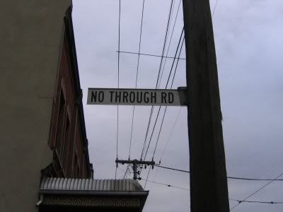
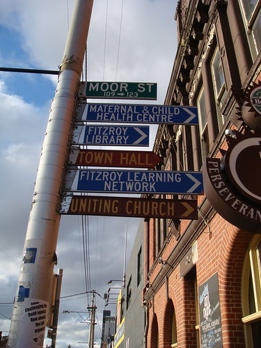
An interesting bit of trivia over on Sociological Images about street signs. Lisa commented that in New Orleans, many of the corners have the street names embedded in blue and white tiles, like this. Her comment was that such signage is of no use to motorists, and isn't it interesting that such things were planned with pedestrians in mind?

This reminded me of how quaint I found much of the signage in the UK when I first visited, because a lot of the street signs are less than a metre off the ground, and are positioned 'behind' the pavement on fences, etc. Again, great for pedestrians, but can be annoying for newcomers trying to navigate around! Luckily, however, it's almost impossible to drive quickly through London city back streets (for e.g.) because they were not built for cars! Here are some (naughtily hotlinked) examples:


In Melbourne (and Victoria generally), street signs are much higher off the ground, and most often right on the corner of the street (on telephone (telephone?) electricity poles or on their own poles). They're also quite a bit smaller. It's interesting to see the difference in perspective of all the photos when googling for images of London street signs and Melbourne street signs! Again, apologies for hotlinking.


Anyway, I just thought it was interesting. Mainly because I am kind of fascinated by signs, and street signs are so ubiquitous and so location-specific, yet most people hardly think about how they change the landscape visually, and how they construct the environment spatially.

12 July 2010

WALKING OUT OF THE CITY: DAY FOUR

Saturday 3 July 2010
Ringwood to Lilydale
23km / Approx 7 hours
Map
My photos


the before pic
G, J & D just beside the freeway in Ringwood: our ‘before’ picture


“A shift in atmosphere or perspective”. That’s what I wrote in the first post in this series about walking out of the city, thinking about boundaries and subtle borders that only appear obvious in the crossing. The shifts I’ve mentioned so far have been from inner to middle suburbia (and now from older to newer outer suburbia), from river- and creek-side paths to roadside walking, from more-accessible to less-accessible terrain, from familiar to less-familiar, from MFB to CFA territory and back again, from the hard surfaces of asphalt to loose gravel or soft grass underfoot, from residential to agricultural/horticultural land use, from the solid, regimented lines of human construction to the more relaxed, fluid shapes of ‘nature’. And all the while, the boundary most obvious is between city and not-city.
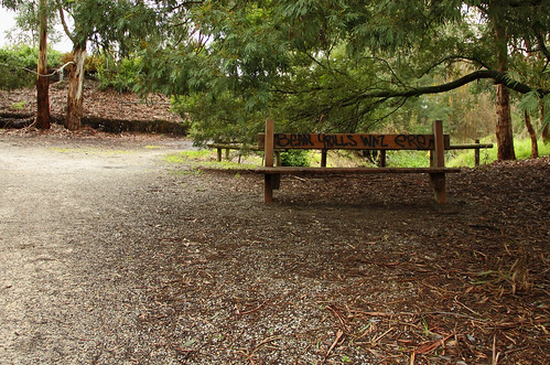

Bear Grylls would surely not go adventuring in the city! We must have entered the wilderness! (Photo by GT)


In all of this walking and investigation I wonder if, more often than not, I have been searching for a spatial border (or borders)? Or have I been walking to the (re)realisation that physical, geographic, cartographic and administrative circumscriptions are only one way of locating a city? I’ve been reading Benedict Anderson on imagined communities, and although he uses this phrase to refer to nations, the concept might also be applied and adapted to any number of networks, groups, communities – including that of ‘the city’. In this formulation, then, spatial boundaries are only one way of imagining the city. Other imaginings occur through music (songs like Carlton (Lygon St Limbo) or Four Seasons in One Day, or one of these other songs), or sport (an imagining of the city through AFL or VFL clubs, for example), or news about violence (gangland killings, anyone?), or the daily interactions we have with other people in schools, shops, workplaces, on roads or bike paths, with cleaners or bankers or ticket inspectors (“I suggest you take a long hard look at the reflection of yourself in the tram window in your deceptive, unattractive plain clothing uniform and ask yourself,” recites Yana Alana, “Was it always my dream to become a ... motherfucker?”). This is the city as imagined through the circulation of local newspapers, the dissemination of home delivery menus, discussions of the weather, the suggestions to visitors that they try this restaurant or that bar, wearing of badges with Melways maps on them, community mapping projects like ToilArt and Feral Fruit Trees, coffee snobbery (which has surfaced a few times in this series of posts!) and speculation about whether ‘we’ will vote Green in the next election now that Lindsay Tanner is resigning. The urban city might be imagined in relation to the suburban sprawl, rural farmland or remote bush. Melbourne might be imagined in relation to Sydney (From St Kilda to Kings Cross) or Adelaide, in relation to Victoria, in relation to Australia – or in relation to major cities in Melbournians’ countries of birth (UK, Italy, Vietnam, China, New Zealand, Greece, India, Sri Lanka, Malaysia and the Philippines were the top 10 in the 2006 census). Present-day Melbourne might be imagined in relation to Melbourne of 20 years ago (see the clip for the Skyhooks’ Lygon St Limbo, above), or the colonial town of 150 years ago, or the pre-colonised land of the Wurundjeri, Bunerong and Wathaurong people. At any rate, this Melbourne and this idea of the city coheres around psychic and interactive (person to person, to environment, to institution, etc) elements, rather than being circumscribed by spatial boundaries . . . in which case, how might one walk out of the city?

ringwood suburb, you have my apologies
The back blocks of Ringwood, next to the Mullum Mullum path

some kind of eucalypt flower
Eucalyptus of some description, Croydon Hills
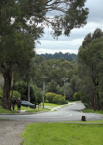

Croydon Hills. (Photo by GT)


Perhaps it’s that as we walk further ‘out’, I walk further from ‘my’ city, the place where I spend my everyday. This much is obvious in my continued surprise at the suburb of Ringwood – mentioned last time as being quite nice, really, and living up to that standard during this leg of our walk. We used the facilities in Eastland (what an exciting experience!), then headed to the Mullum Mullum path, ducking under the freeway and heading into the quiet Saturday morning suburbs. We saw Maned Wood Ducks, some mallards, lots of joggers and dogs – including one adorable black puppy called Bella, who was very friendly and happy to meet ALL THE PEOPLE EVER! After about 6kms, we left the creek and followed streets (mostly with footpaths, unlike our road-walking sections through Park Orchards last time!) for a few Ks to the section of bushland called Hochkins or Hodgkins Ridge Flora Reserve. We weren’t sure that there’d be tracks through the reserve, but luckily there were (for anyone following our footsteps, you need to take the second gate into the reserve – the first path leads down to the creek). The rain that had been threatening all day finally descended before we had the opportunity to break out the thermoses – we were really hanging out for a cuppa by the time we got to our lunch break a few kilometres later. In the interim we enjoyed the rest of our time in the reserve, then turned east along the road at the northern end. My Melways says that this is the proposed route for a northern arterial road, so we made sure to enjoy the peace and quiet and our ability to meander across the grass by the roadside, because in a few years time it might be gone. Turning south again, we passed by a primary school and – more interestingly – some hilarious goats, before finally trudging to the shops on Exeter Rd in Croydon North and settling in under the shelter of the op shop verandah for food and tea.

g & d brave the drizzle
D&G before the rain settled in, walking through Hochkins Ridge Flora Reserve

g & d: raincoat hoods up!
G&D with hoods up against the rain, a few minutes later!

OH HAI, I'M A GOAT!
GOAT!!!

g & d eating lunch
Food and shelter! Excellent!


The differences between here and, say, Thornbury at the start of this walk, are quite significant. Although we might both consider ourselves Melbournians (or Melburnians, if you prefer that spelling), my Melbourne is going to be very different to the Melbourne of someone who lives in a big house in Croydon North (not an apartment in the inner northern suburbs), commutes to a full time job in one of their cars (not to a part time job on the tram or to uni on foot), who sees the city from wide suburban streets, a freeway or bypass (instead of from laneways, bike paths and CBD streets), who drives their kids to school, sport or music lessons (no kids, no car) . . . We sat under the verandah and watched this other world go by. People said hello to us, smiled, or rushed to their cars as the rain picked up again. We wondered how much our white/age/class privilege allowed us to set up here and have a picnic lunch where others might be less welcome or more likely to be told to move on and stop loitering.

ESTHER CR.
I thought some of the Esthers in my life might like this!


Having talked about how my imagining of ‘the city’ might differ from someone else’s, I should also mention that my own ideas of ‘the city’ and of Melbourne are also in constant flux. When I was a kid, my family used to drive 400+kms from the bush in East Gippsland to Melbourne to visit family during school holidays. Mostly we would stay with my Oma, and I remember ticking off towns and getting more exciting the bigger they became: Bairnsdale, Sale, Traralgon, Moe (almost an outer suburb in my mind!), Berwick (definitely in Melbourne!) and then finally our destination – the overwhelming metropolis of Croydon! To me, the area around Croydon was Melbourne, it was the city, and I could barely differentiate between Croydon and the CBD (the only real difference was that the big gallery was in the latter, and the trains went underground). It’s funny to think that now Croydon registers as an outer suburb to me – meaningful only in memory (“I know where we are,” I said as we crossed the end of Dorset Road, knowing I could walk a few kilometres – right on Lincoln Rd, left on Croydon Rd – and be at Oma’s house . . . only it’s not Oma’s house any more, and I would probably have cried), and in relation to other places (it now seems so close to the Dandenong Ranges National Park – a favourite walking haunt of ours). It’s also strangely familiar and unfamiliar now, because not only have things actually changed, but my perspective on them has changed, particularly as a walker rather than a passenger in the back seat of a family car.

BUTCH
D in Mooroolbark. I thought I was being very amusing making him pose for this photo.

pipeline, mooroolbark-ish
We walked a few kilometres along the path of this pipeline.

g on the pipe track
You can see all the new suburbs springing up before your eyes. And hardly a solar panel in sight.


Consulting the map! (Photo by GT)
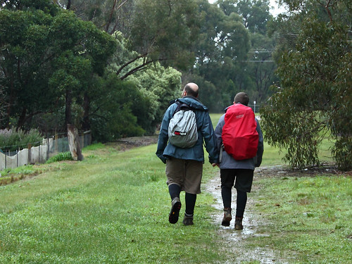

And off we go! (Photo by GT)


Walking along the pipe reserve reminded me a bit of walking to Epping - and how interesting that the linked post also talks about the yearning to walk out of the city! I realised that this ‘reminds me of’ game is one that I’ve been playing since we left Eltham, since we started walking where we’d never been before. I guess most people do this without thinking: “This street in Melbourne reminds me of that street in Berlin”, “These tube station names in London remind me of suburbs in Melbourne”. This seems to create a psychic palimpsest of the city – the London underground map sits distorted over Tottenham and South Kensington, the Rose St market in Fitzroy sometimes merges into the flea market in East Berlin, the smell of coffee and sewerage near the Queen Victoria Market invokes echoes of Barcelona, the crowds of tourists in Fed Square (FEDDO!) pale in significance with the claustrophobic summer throngs of Rome or Venice, and whenever I travel on the Tullamarine Freeway I get a little thrill of travel excitement and remember all the other airports I’ve been through in Singapore, Canada, Japan, New Zealand, Hong Kong, London, Abu Dhabi, Amsterdam . . . This city is personal, psychological, emotional, and clearly a result of individual circumstance.

someone to watch over me
Street art – another thing Melbourne is known for. Although usually it’s the art in the inner city laneways that gets all the attention.


Well, this post has been rather heavy on the abstract, and hasn’t focussed as much on the actual walking experience! I suppose that story comes through more in the photos and captions (it’s rather like a supplement in a Derridean sense – OMG theory wanker!). It was, overall, a really lovely walk through some unfamiliar (to us) territory. We all enjoyed the Olinda Wetlands and Lilydale Lake in particular. In fact, the last section of the walk was probably the most spectacular, which is always a good way to end! Lilydale Lake was a wonderful mirror of the sky as the cloud lifted, the rain stopped, the sun set and evening fell, and we agreed that the lake and wetlands would make a lovely afternoon outing for a picnic in drier weather.

olinda wetlands with rising cloud
Olinda Wetlands

olinda wetlands reflections
We joked that we’d walked on the toe-hills (rather than the foothills) of the Dandenongs, but the heavy cloud meant we didn't really get to see the hills for most of the day. The cloud only started to clear towards the end.
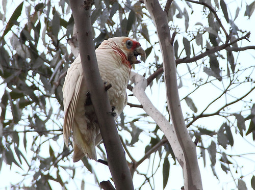


Long-billed corella making a racket in the tree beside our picnic table. (Photo by GT)

lilydale lake reflections 2
Lilydale Lake – how’s the serenity?!

lilydale lake reflections 3
There are even little beaches around the side of the lake!


This day of our walk to Warburton, alongside the reading I’ve been doing, has lead to a shift in my perspective. In a way, I am now inclined to see the line that our footsteps have traced as evidence of the city (my city) expanding, and also as part of an extension of what ‘the city’ in general (and ‘Melbourne’ in particular) means to me.

the after image: long exposure and creepy eyes!
Tired out after a long day. The train ended up packed with Collingwood supporters on the way to the Saturday night game at Docklands – what did I say about Melbourne being imagined as footy town? It’s true!

1 July 2010

WALKING OUT OF THE CITY: DAY THREE

Tuesday 15 June 2010
Eltham to Ringwood
24km / Approx 7 hours
Map


Having recently walked for miles in the bush of the Dandenong Ranges National Park, I was prepared to be disappointed with this walk – I was half-expecting it to run through housing developments, with the Mullum Mullum Creek resembling the concrete-drain sections of Moonee Ponds Creek. Not, I hasten to add, that this would be a bad thing, just that I think I secretly wanted my walk out of the city to have a neat progression from urban to rural, and I expected this section to defy my preconceived narrative needs! . . . It did – but, delightfully, not in the ways I anticipated. For example, I did not expect to walk past a group of kangaroos just after the confluence of the Mullum Mullum and the Yarra, I didn’t expect the stretch of the creek down to Tindals Road to be quite so forested, I didn’t expect the roadside walking to be quite so hilly and quite so nerve-wracking (no footpaths!), I didn’t expect the 100 Acres reserve to feel so ‘natural’ and so large. I certainly didn’t expect what we saw of Ringwood to be so unlike the Ringwood I’d built in my mind – the freeway, Maroondah Highway, Eastland and the railway station were packed together within a kilometre at the end of the walk, and what we saw of the rest of the suburb was full of quiet courts and leafy streets, with unexpected views of the Dandenongs as we turned a corner or topped a rise.

SUDDENLY MOUNT DANDENONG!
Getting closer to the Dandenongs - it feels like we're really making progress!


One thing that I really enjoy about walking is the real physical connection it produces with the surrounding landscape, and the way it can invite a re-think of the way in which our environments are structured and imagined. I’ve been paying particular attention to the ‘feeling’ of the places we’ve been passing through on this walk out of the city and asking myself why they feel the way they do. Is this spot easily defined as part of one council or another? How do we conceptualise these kinds of boundaries? What kinds of buildings are there – flats or apartments, houses, light industrial – how old are they, and how big are the blocks of land? Are there other people around, and, if so, what are they doing? How does the presence of a river or creek change the feeling of a place? What can I see from here, and (sometimes more importantly) what can’t I see? Which sounds and smells are dominant? Are there signs of birds or domestic animals? Am I reassessing my ideas about this suburb (Ringwood!) or place, or even about the city itself?

machinery returning to nature
Unexpected tractor carcass, making me wonder exactly how far from the city we were!


We started in Eltham, and I grabbed a coffee before we set off along Diamond Creek. This area is beginning to seem quite familiar, even though this is really only the third time we've walked here. I remember feeling similarly about Belgrave the third or fourth time we headed out to walk in Sherbrooke Forest, and it makes me wonder how long it takes other people to feel familiar with a place? Not to know it in that way that only really comes with years of treading the same paths (and even then, perhaps the longer you walk in one place the more variable and unpredictable and different it might become - I couldn't say for sure!), but just to get that comfortable feeling of, "Oh yes, here I am again".

Old fire bell, Eltham CFA
I got a couple of shots of the old CFA bell this time.

Smith, Phillips & Dawson bell, Eltham CFA
You can read more about it here.


We trundled off past the (full size) trestle bridge and over the miniature train tracks down to the Yarra, and crossed at the footbridge. From there we turned left, heading along the boardwalk into completely new territory (for us). Not only was it a new path, but we'd forgotten to bring our map! Again! Considering how prepared we like to be, and considering my slight obsession with cartography, this walk out of the city has so far been almost map-less. I recited what I could remember to D, and drew up a sketch map from memory, and we decided that our first tactic would be to ask people for directions, and our second would be to consult Google Maps on D's phone (if we could get it to work). There is something both freeing and constrictive about not having a map, I find: in some ways it really encourages a closer connection to the physical elements of walking (the topography, the roads and signs on the way, your body's own way of measuring distances and times) and with other people (asking for directions, for example), whilst also averting the mundaneness of knowing exactly where you are on (what in this case would be) the familiar grid of the Melways; in other ways it means not having the ability to change your route, to head down a path with the knowledge that it will eventually join up to the route you'd planned (on a 24km walk I really don't want to come to a dead-end some half an hour down the track), to get a wider impression of the area in which you're walking (what suburb you're in, what's going on over that hill just there). There are things to recommend both options!

j gives this bridge (and this coffee) thumbs up
Thumbs up to the bridge and the coffee!

dan waits to cross at the miniature railway in eltham
D waiting to cross.

WILLIAM G PERT RAILWAY WORKSHOPS
Miniature railway workshops and turntable thingy! (What are they called?!)

yarra from the footbridge near diamond creek
Yarra from the footbridge near Diamond Creek.


The path takes you between the Yarra and a large (organic?) apple orchard - another thing we'd never have realised was there had we not walked past it - which apparently has an organic fruit and veg market on Fridays and Saturdays (read more here). You curve around southeast to the confluence of the Yarra and the Mullum Mullum, where an information sign tells you some of the history of the place - particularly its significance to local indigenous people. Across the creek stands Pontville Homestead, Victoria's oldest pioneering residence still on its original site, and it might be a place to go back and explore later. Just a few minutes further down the track in Tikalara Park we stopped a jogger and asked for directions . . . and then noticed a mob of kangaroos lounging beside the creek! If it weren't for the pylons marching to converge upon the power station, we could almost have been on the outskirts of a country town rather than less than two hours walk from the met train. Another kilometre took us to Beasley's Nursery and Teahouse which we visited mainly for the toilet, though we ended up sitting at one of the mosaic-topped tables and having a drink because it was so inviting!

blue tractor at petty's orchard
Tractor at Petty's Orchard. I thought my dad might like this one!

Pontville Homestead
Pontville Homestead.

kangaroos (i think) in tikalara park
Kangaroos!

a pylon moot
Pylons!

mosaic ducks at beasley's nursery
Our table at Beasley's Nursery


The next few kilometres were extremely pleasant. We were very much in the swing of things, and the Mullum Mullum trail was easy to follow. We watched cockatoos flying through the treetops, saw a flock of rosellas or parrots or something hanging out on one verandah taking turns in the bird bath, passed a small group of people quietly planting grasses and shrubs beside the path (my guess is Friends of Mullum Mullum Valley, stopped for lunch at a well-placed picnic table. I'd imagined that this section was going to be much more like an inner-suburban creek: nice, but closely hemmed in by houses. The houses were there, for sure, but it felt a lot less suburban. Unfortunately for you, dear reader, we were so busy enjoying ourselves that we forgot to take many photos!

HAVE YOU SEEN A KOALA TODAY?
Nope, only kangaroos.

d taking a business call
D at our lunch spot - not at work, but they still call him!


The next section, though, was very different, and I want to take a moment to consider some of those differences. Often, I read promoters of walking saying that it's the easiest and cheapest and most accessible and environmentally friendly way of getting around or spending your leisure time or getting some exercise, and it's easy to agree. I only have to step out of my house onto an even pavement, walk a couple of minutes to the smooth bike track beside the Merri Creek, stroll down the alleyways . . . it's easy, cheap, accessible, no-carbon. Now, when I planned this route, I consulted the Melways and Google Maps (on mapmyhike.com) to trace the greenest route I could find between Eltham and Ringwood stations, but even so I knew there was going to be a couple of long sections of road-side walking. Noting that most of this was going to be in areas with a significant amount of housing – big blocks, I thought, but not exactly uncivilised – I think I assumed that there would be either sealed footpaths or informal paths alongside most of the streets. After all, it's still the city! I was wrong. Between Mullum Mullum Creek and the 100 Acres there were small stretches on unsealed tracks off the road, but most of the time we were walking on the shoulder of the road, crossing before blind corners in order to stay as safely visible as possible, backtracking and scrambling up and down cuttings to avoid dangerous bends, traipsing through weeds and grass, and picking our way along the gutters and drains.

As we made our way along Stintons Road, constantly alert for traffic, I thought again about the meaning of 'easy', and for whom and in what circumstances walking is 'accessible'. D and I agreed that this part of the walk was actually not too bad - it was interesting, there were good views, and we felt rather intrepid. But – and this is key – this is only because we are relatively fit, mobile and able-bodied, and probably also because we were determined to get to our destination (where else would we go?) by foot (because we didn’t really have another option). It is a somewhat ironic state of affairs. There we were in lush green surroundings with views over rolling hills, smatterings of bush, paddocks with horses, fresh(er) air and the sound of birds calling . . . and it was almost completely inaccessible to anyone who was not in/on a motor vehicle (cycling would also be nervewracking in some parts of this route) or who wasn’t a landowner. It was certainly not accessible to people in wheelchairs, or to anyone pushing a pram. I don’t want this post to turn into a rant or get completely bogged down in a discussion about the politics of land ownership and urban planning, but I think this is something of a paradox: people tend to think of the freedom of being out of the city, but sometimes as we get further from the city, the environment actually becomes more restrictive.

somewhere warrandyte/park orchards-ish
View from the roadside.

PLACE OF LAST RESORT!!!
This amused me!


Eventually we reached the 100 Acres reserve (not the Hundred Acre Wood!), snapping a photo of the map on the information sign before we plunged in. The 100 Acres apparently used to be orchards, before the military purchased it early last century. Since the end of the second world war (I think), it has been left to re-vegetate, and it is now a public reserve. It is a really lovely spot, big enough to spend a couple of hours exploring without retracing your steps, but small enough that it would be difficult to get lost. We had a cup of tea on one of the benches scattered around the place before heading out onto Berringa Road.

white heath (Epacris impressa, I think)
Epacris impressa, I think? The white version of Pink Heath that is Victoria's floral emblem?

slightly sinking sun
In the 100 Acres reserve.

d makes tea
Time for tea!


From here, it should have been an almost straight walk south to Ringwood Station, but a wrong turn sent us on a detour, adding a kilometre or so to the distance. Luckily we weren't too pressed for time, so we enjoyed having a stickybeak at the surprisingly peaceful and attractive part of Ringwood (even if we did have to climb a hill!). All too soon - and it felt quite sudden indeed - we were crossing the freeway, passing Eastland shopping centre, and heading into the station. It was a bit of a shock after such a rural-feeling meander through suburbs that could hardly be described as suburban to find ourselves back in the thick of things.

The Freeway
A lot of people choosing driving over walking or riding . . . but considering how far it is between stations, I'm not sure I blame them.

EASTLAND (or EASTLANDS if you want to make it sound like NORFLANDS)
Eastlandsss!


It took us some time to get home on the train and tram, watching the fiery sunset and dozing off. It is actually rather satisfying to think that we have walked all this distance, that we are getting somewhere, wherever that might be . . .

j & d in the 100 acres flora and fauna reserve
Us in the 100 Acres reserve


And tomorrow we are heading out to do the next leg - a section that will bring us almost to the foot of the Dandenongs!